1/22
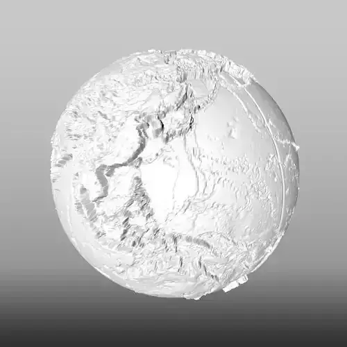
This 3D model is a representation to scale of the terrestrial globe, as you may have noticed, the dimensions represent the continents according to their real size and proporsions. Since many maps tend to exaggerate the dimensions of some countries or islands for example Greenland that always seems bigger than Africa, which is not true, since Africa is 14 times bigger. That is why I have dedicated myself to making several models of the terrestrial globe. In this model you can also see the relief and you will see that the files weigh several megabytes since it required too many vertices (258482) and polygons (516960) to make a portrait as close to reality, although I have added a textures (downloaded from the nasa page), to simulate the color; I have also added the renderings both with and without texture, so that you will notice that it is done in detail.measurements:X = 12.756 cm (127.562 mm)Y = 12.714 cm (127.136 mm)Z = 12.756 cm (127.562 mm)
Enjoy it.
Este modelo 3D es una representacion a escala de globo terraqueo, como lo habran notado, las dimensiones representan los continentes segun su tamaño y proporsiones reales. Ya que muchos mapas tienden a exagerar las dimensiones de algunos paises o islas por ejemplo groenlandia que siempre pareciera mas grande que africa, lo cual no es real, ya que africa es 14 veces mas grande. Por eso me he dedicado a realizar varios modelos del globo terraqueo. En este modelo tambien se nota el relieve y veran que los archivos pesan varios megas ya que requería demasiados vertices (258482) y poligonos (516960) para hacer un retrato lo mas pegado a la realidad, aunque le he agregado una texturas (bajado de la pagina de la nasa), para simular el color; Tambien he agregado los render tanto con y sin textura, para que se notara que es realizado al detalle.medidas:X = 12.756 cm (127.562 mm)Y = 12.714 cm (127.136 mm)Z = 12.756 cm (127.562 mm)
REVIEWS & COMMENTS
accuracy, and usability.


