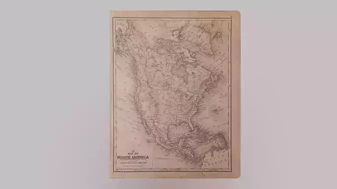
1800 Map of North America

1800 Map of North America Low-poly 3D model

Description

This is a map from 1800 which depicts North America and the very top of South America. It was created based off of an authentic map I have in my possession. This would be useful as a decoration in many scenes (for example: on a wall, in a frame, on a desk, in a professor's study, in a Captain's Cabin, or something along those lines). If you enjoy this model please give it a like, a good review, and visit my store where I have many other similar models for sale. If you have any questions about this asset, or about anything in my store, please contact me. If you have any issues please do the same before leaving a bad review, because it may be a simple mistake that I can try to fix,

Item rating
0 0
1800 Map of North America
$2.00
 
Custom License 
1800 Map of North America
$2.00
 
Custom License 
Available in these collections
Response 90% in 1.6h
3D Modeling
UV mapping
Shaders
Particles
3D Scanning
Hire meView all Designers Models

3D Model formats

Format limitations
Native
  • Blender (.blend)801 KB
Exchange
  • Autodesk FBX (.fbx)20.7 KB
  • Stereolithography (.stl)1.84 KB
  • OBJ (.obj, .mtl) (2 files)2.87 KB
  • Alembic (.abc)4.25 KB
  • Collada (.dae)9.57 KB
  • glTF (.gltf, .glb)6.23 MB

3D Model details

  • Publish date2022-01-01
  • Model ID#3483867
  • Animated
  • Rigged
  • VR / AR / Low-poly
  • PBR
  • Geometry Polygon mesh
  • Polygons 12
  • Vertices 20
  • Textures
  • Materials
  • UV Mapping
  • Unwrapped UVs Unknown
  • Plugins used
  • Ready for 3D Printing
Help
Chat