1/11
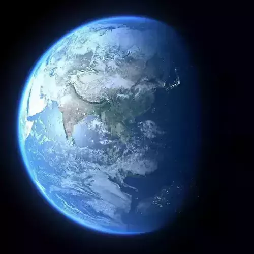
File:All file are filed in the same directory, and there is no case of losing textures. Please double click .mb file to open, or open / import in the file menu in the Maya window. Do not drag .mb file to maya interface. Files include .MB files, all textures , and word document.The compression pack is larger, mainly because the textures are too large.The earth's surface in different months are different in base color, and the angle of sunlight. Other textures, including white clouds, are the same.
Note: be sure to read the word instructions in the attachment first!
software Maya 2015sp 6, MentalRay for Maya 2015sp 6, I install Maya 2015 and mentalRay first, then Maya sp 6 patch and mentalRay's sp 6 patch, or you can use a higher version.It is also possible to render with the Maya's own software render, but it is too slow and the effect is worse.
UVThe UV at the North and South poles has been optimized. There is absolutely no distortion of the textures at the North and South poles. Base Color 43200 * 21600Bump 43200 * 21600Specular 43200 * 21600NightLight 43200 * 21600Clouds 43200 * 21600Although the texture resolution is extremely high, but after optimization, there will be no delay after opening the file, the rendering process will be very smooth, there will never be a stuck or crashed situation, and the rendering quality of the textures will not be declined!
I will post a partial rendering image. Please observe carefully.
One key adjustmentThe earth's material properties can be adjusted by one key, and only one attribute bar can be adjusted.For example: surface color, bump strength, sea/lake/river specular, color / transparency of white clouds, thickness / color of blue sky, etc. can be adjusted. I have written the specific adjustment method in a word file, in the compressed attachment.On the opposite side of the sun, the model will automatically appear night lights. The brightness of the lights, the color, and the speed of day and night switching can also be adjusted by one key. The method is also in the word file.
otherIn order to facilitate navigation, I have turned off the viewport to display the map. But for ease of location, I have drawn a set of mainland contour curves that you can locate based on.
copyrightThis model was done by me in my spare time, not for any company or any other person. If you buy my product, you can use it to make animations, movies, and games. But you can not resell, transfer or give the model in any way without my authorization.About the modelI believe that many people think that making a model of the earth is a simple job, but it is not. Low resolution earth is very easy to be done. However, to achieve the goal of ultra-high resolution and multi-functional adjustable, it is necessary to overcome too many technical difficulties. It is very difficult to achieve smooth navigation, smooth rendering. I personally collected a lot of information to study various solutions. I failed many times. I have now achieved the desired results and contributed the results to everyone.I hope you like it.
REVIEWS & COMMENTS
accuracy, and usability.


