1/6
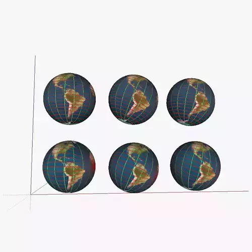
3D model showing a proposed improved system of parallells and meridians for navigation. 6 globes are shown; in the first row of globes regular parallells were kept; the first globe of the first row shows the current system; the second globe shows the the current system with the earth tilted correctly. The third globe has the current 'true north' and 'true south' changed for the magnetic north/south (on the map this is 115° N 80° W or at about the Queen Elisabeth islands near the Ellesmere islands). In the second row, the parallells were swapped with intersecting lines (similar to the system currently used for the meridians); but then horizontally rather than vertically. The second globe again includes the axial tilt of obliquity, and finally, the third one also has the true north/south swapped for the magnetic north/south. See the 'Purchasing_the_models' link at appropedia's AT_CAD_Team for additional information on the model
REVIEWS & COMMENTS
accuracy, and usability.


