

Useto navigate. Pressescto quit
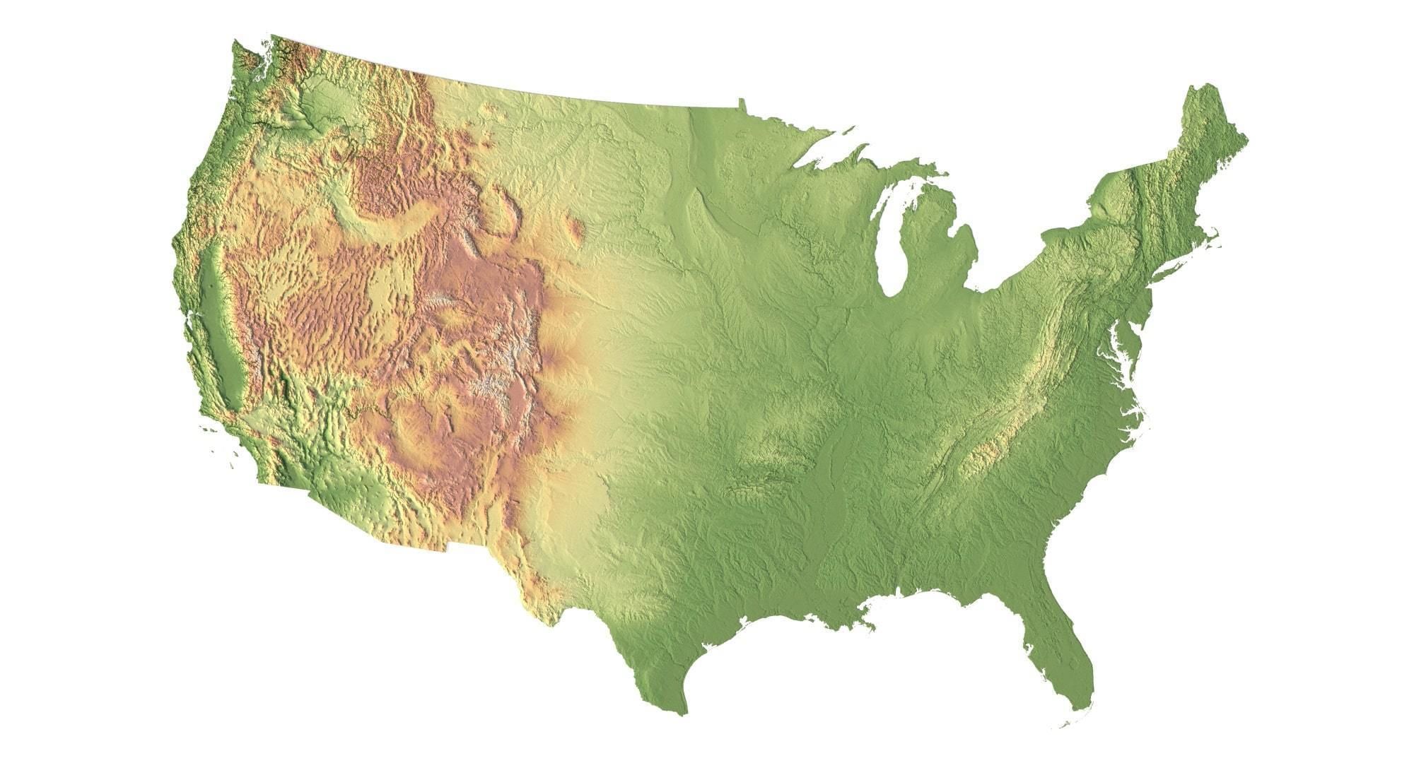
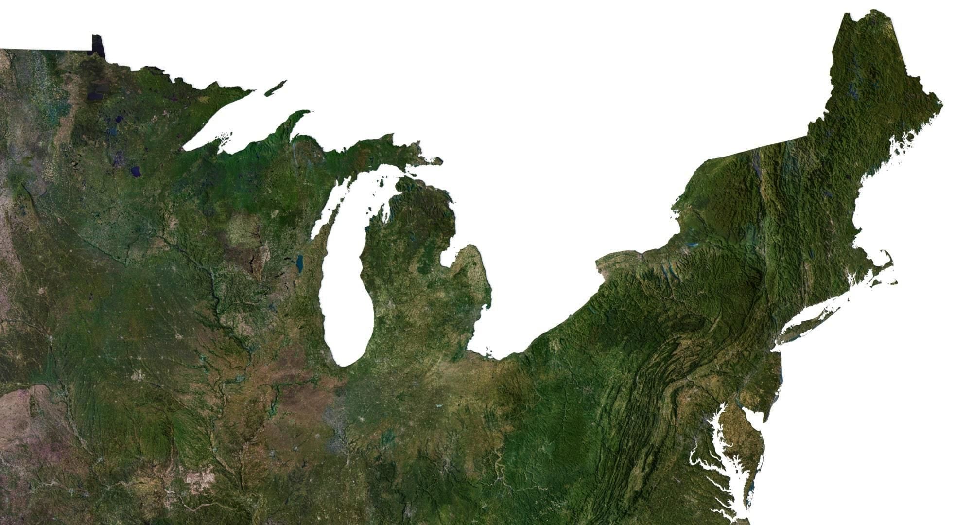
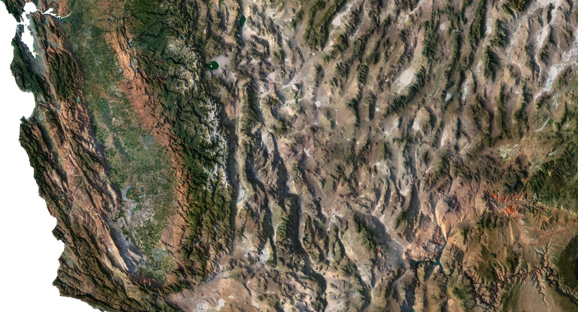
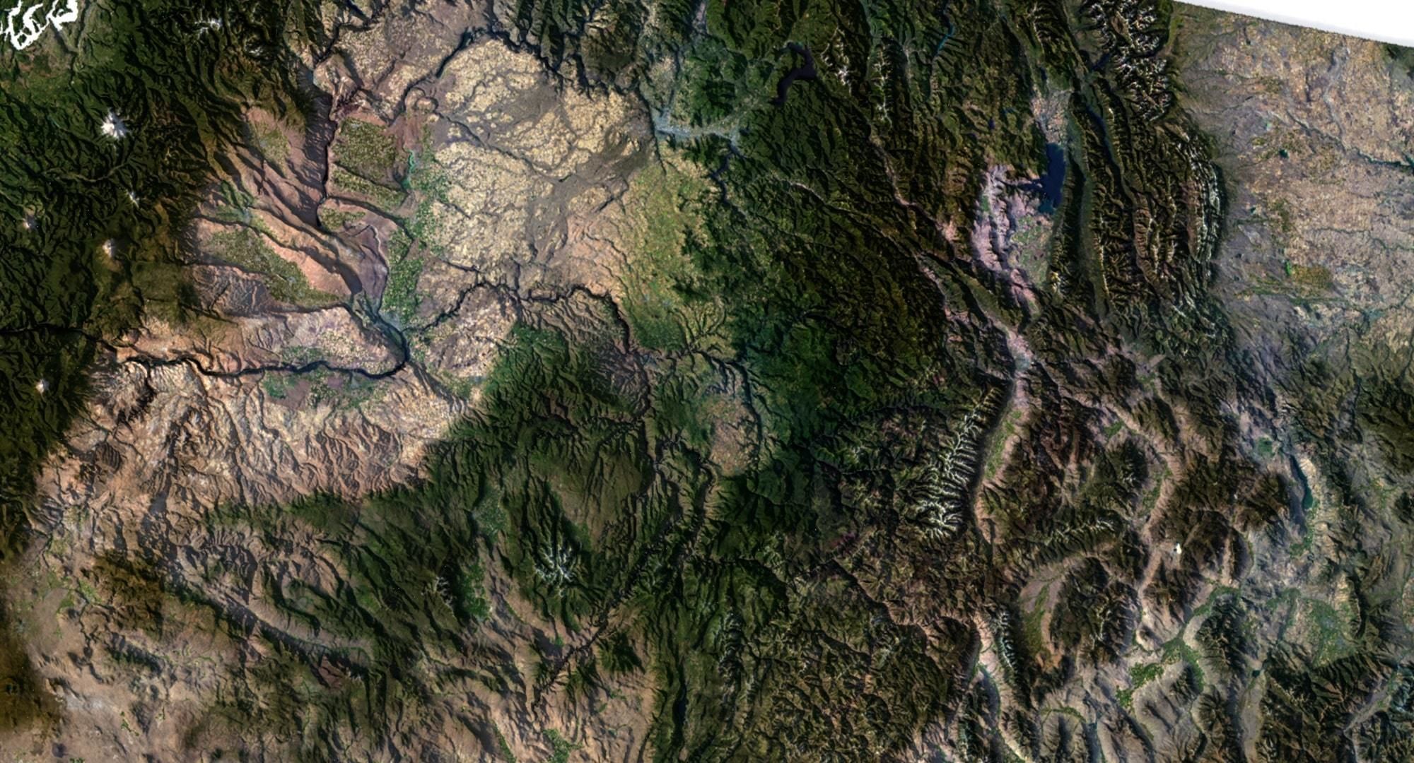
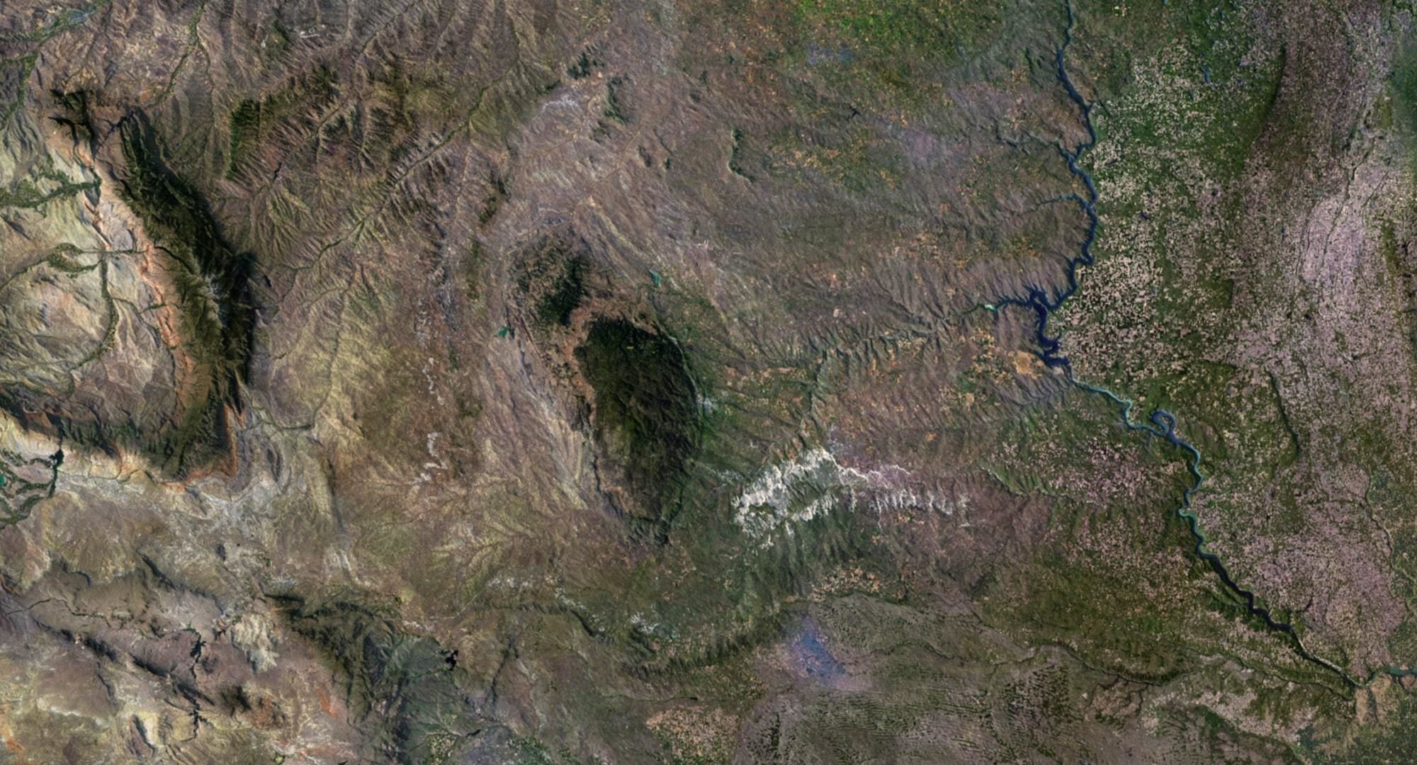
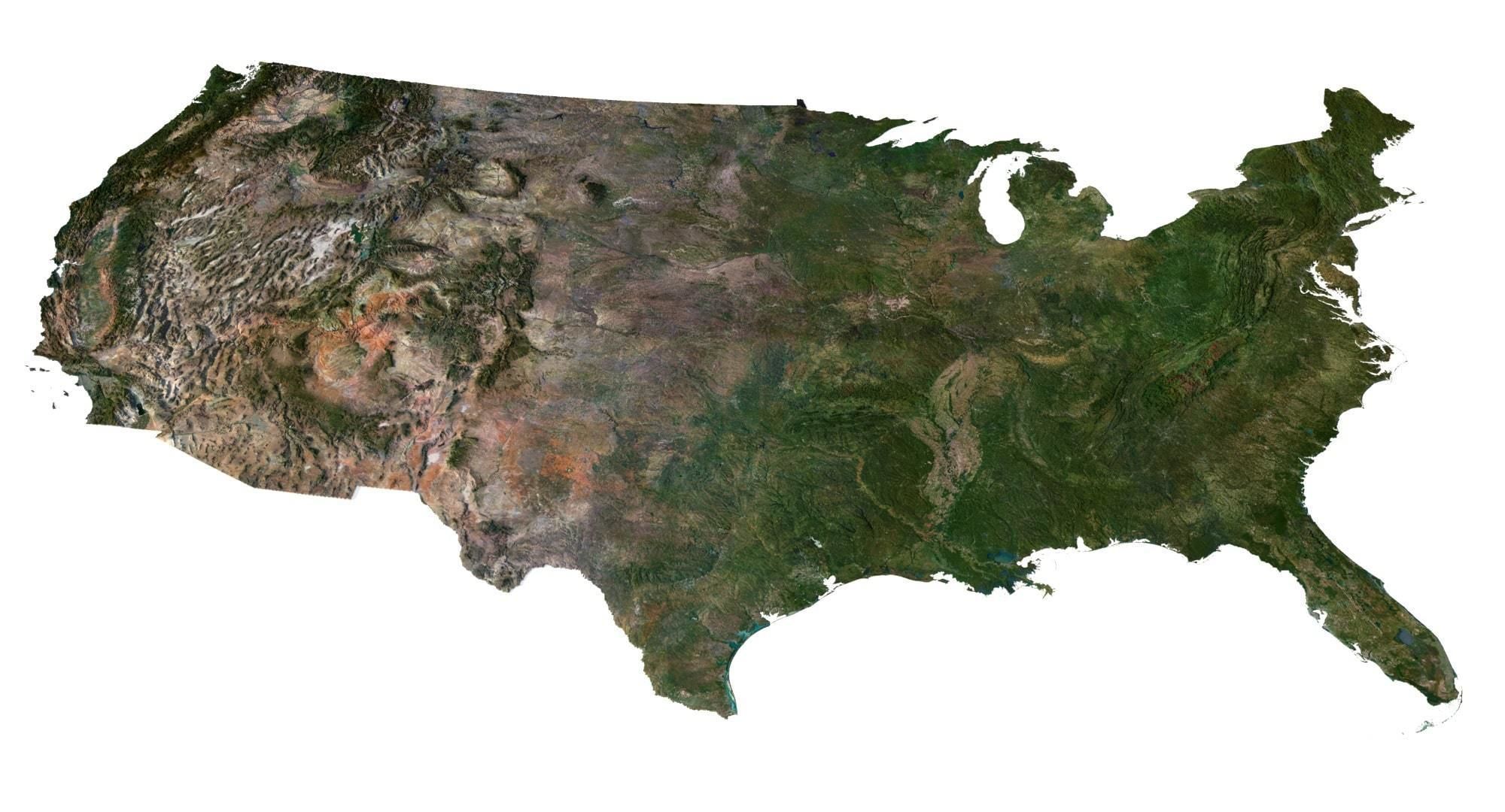
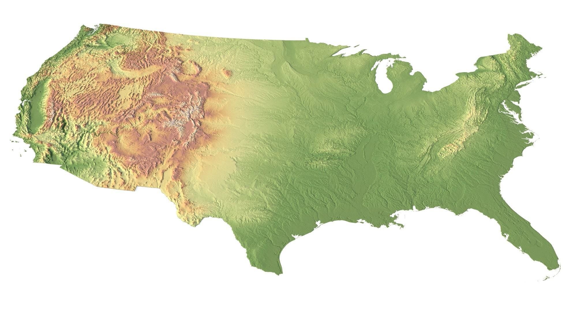
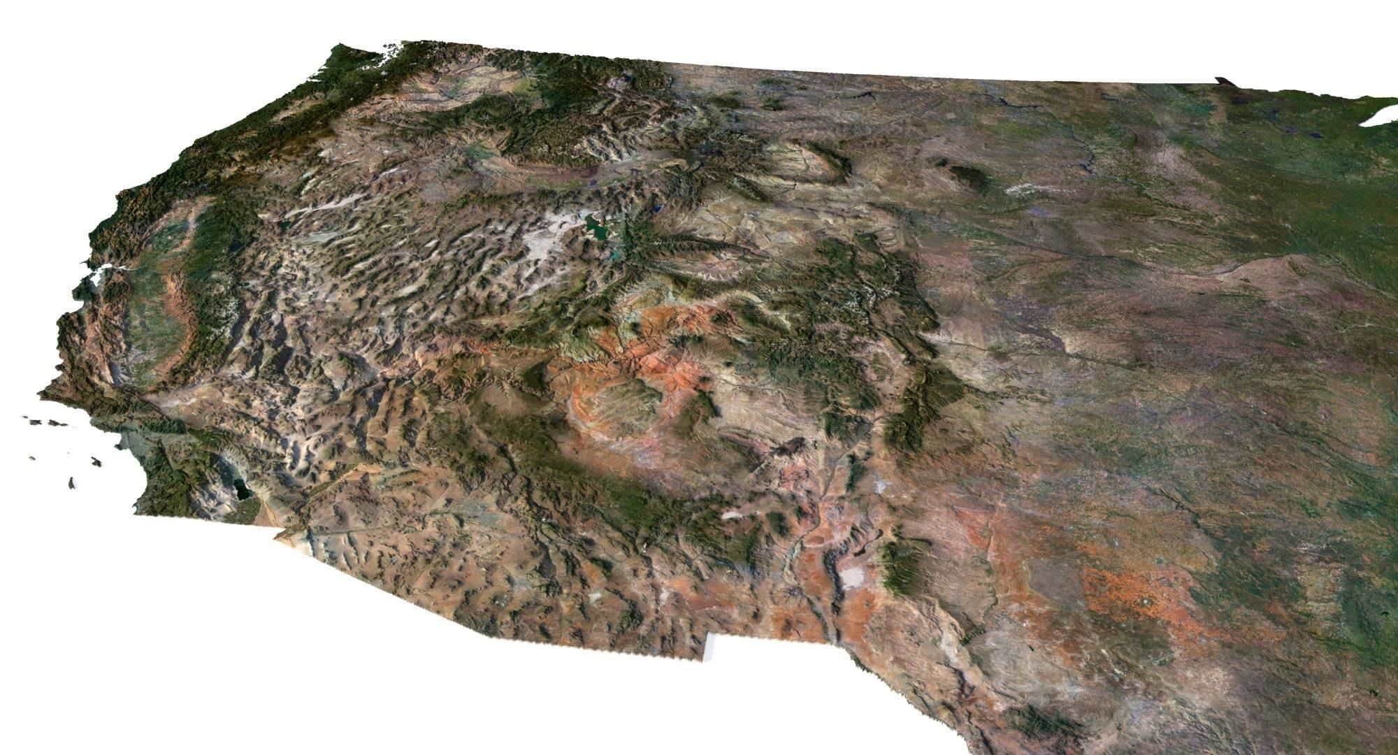
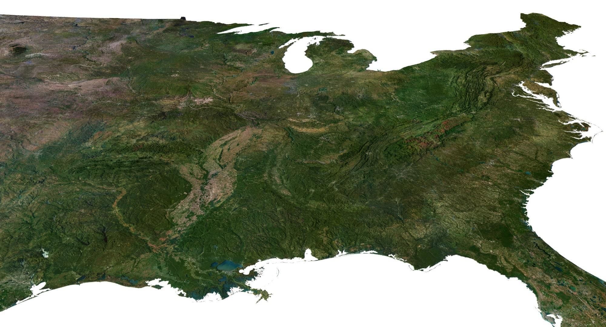
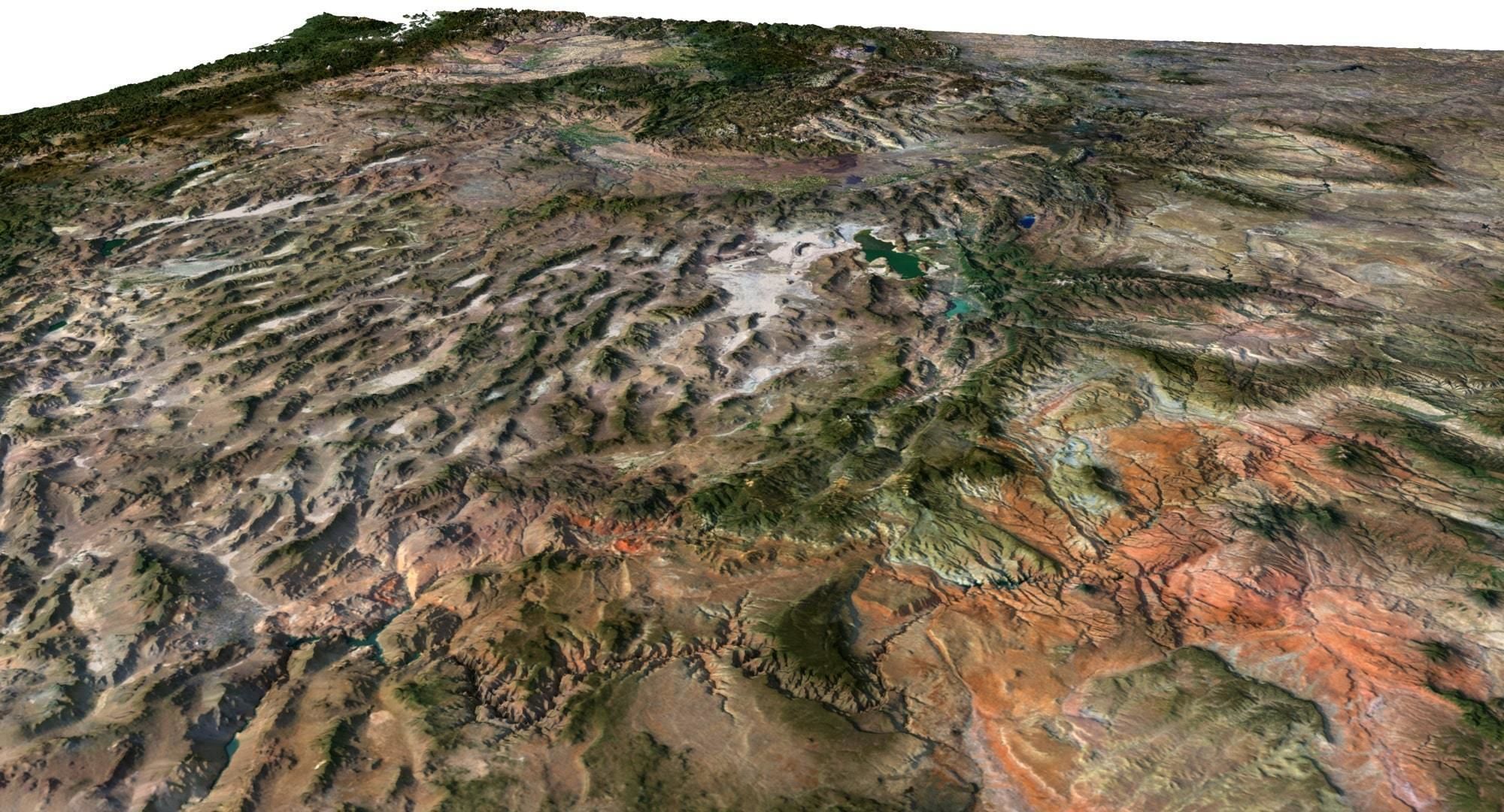
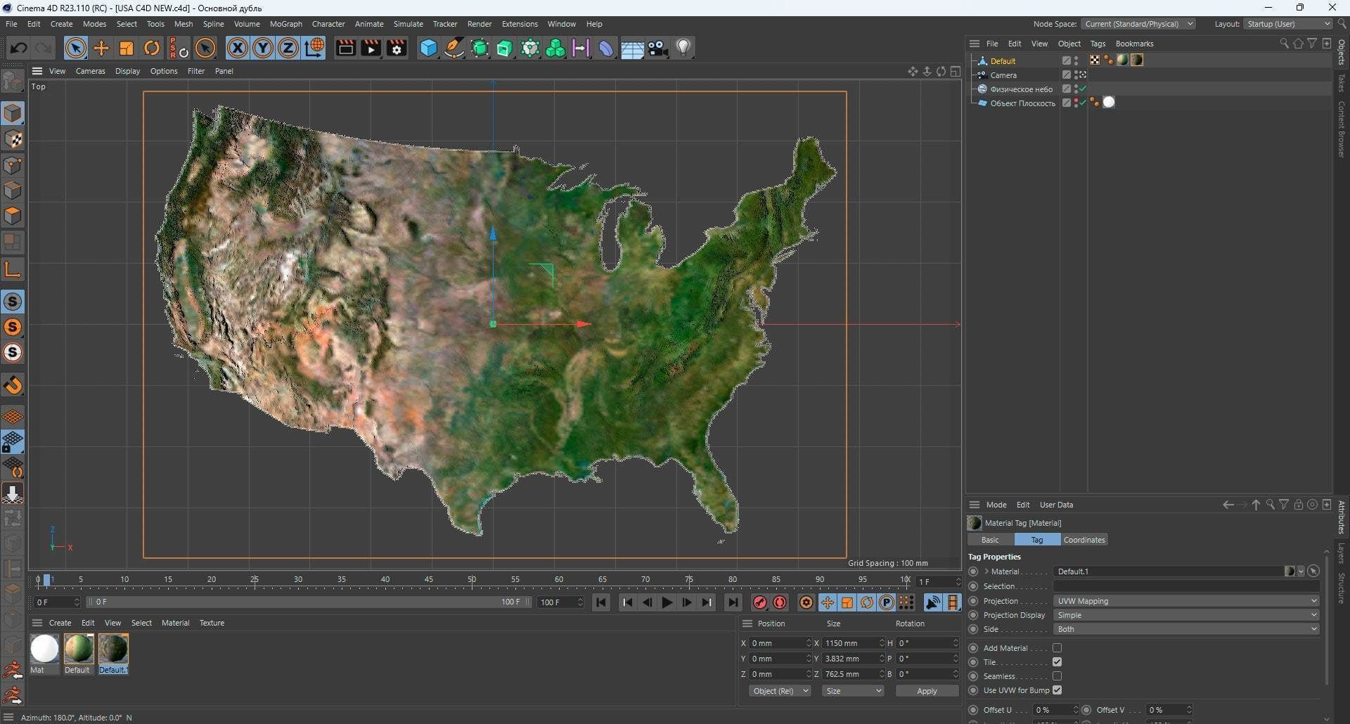
United States Terrain 3D Map 3D model
Description
- Format: C4D
- File size (unzipped): 571 MB
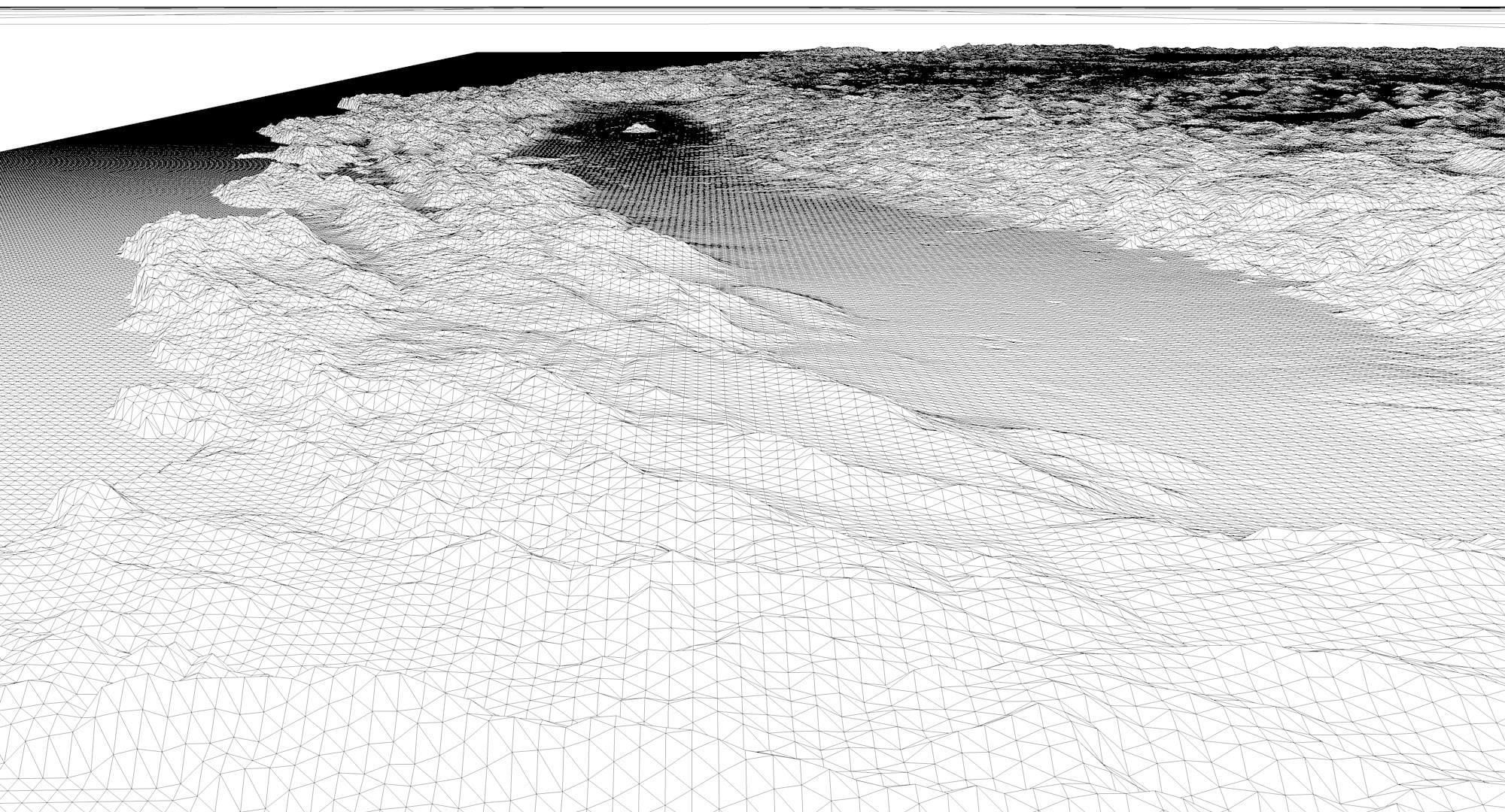
- Polygons: 9 986 310
- Vertices: 4 997 720
- Geometry: Polygonal Tris only
- Model size: 1150 mm x 762.5 mm x 3.832 mm
- Projection: Lambert Conformal Conic
- Base: Open
Textures
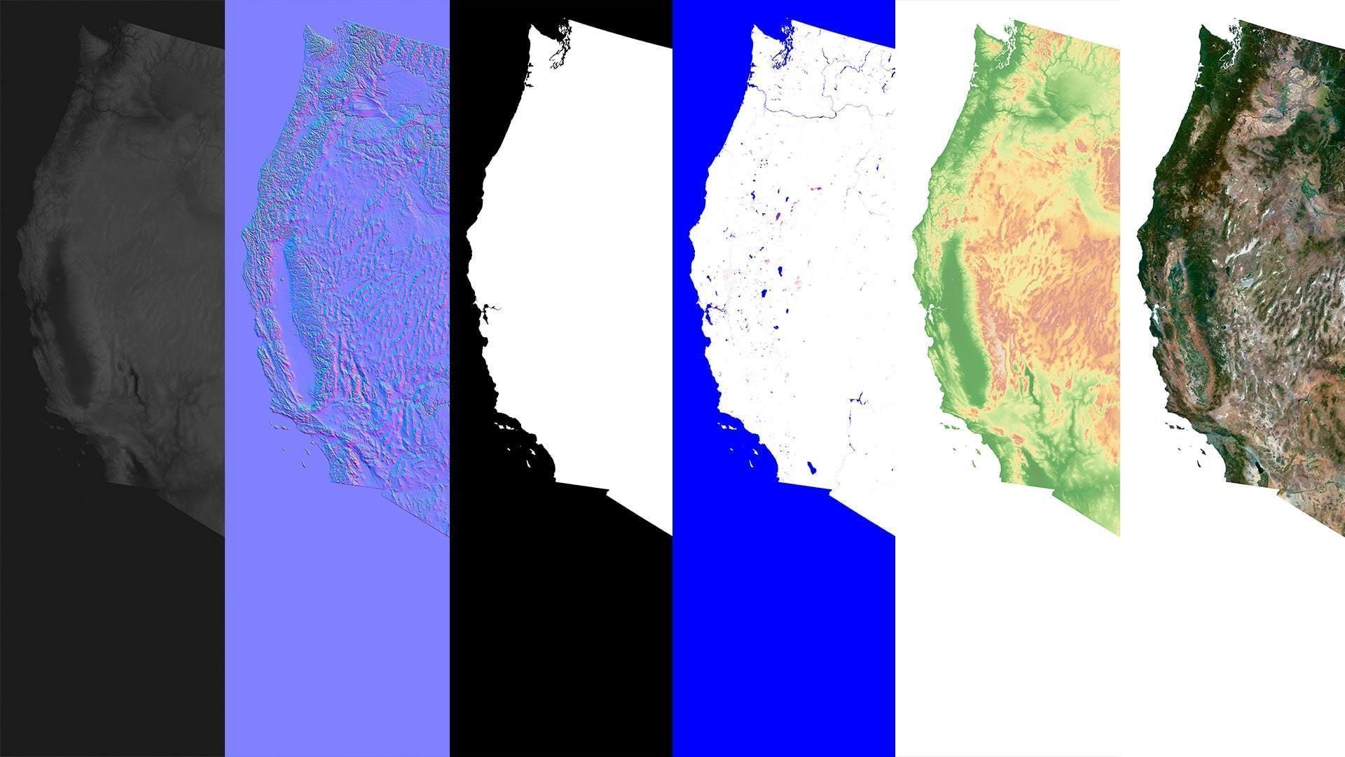
- Height Map TIF 8193*5432*16b - You can use this map in the displacement channel instead of the polygonal mesh.
- Normal Map TIF 8193*5432*48b - Use this map to reveal fine details of the relief.
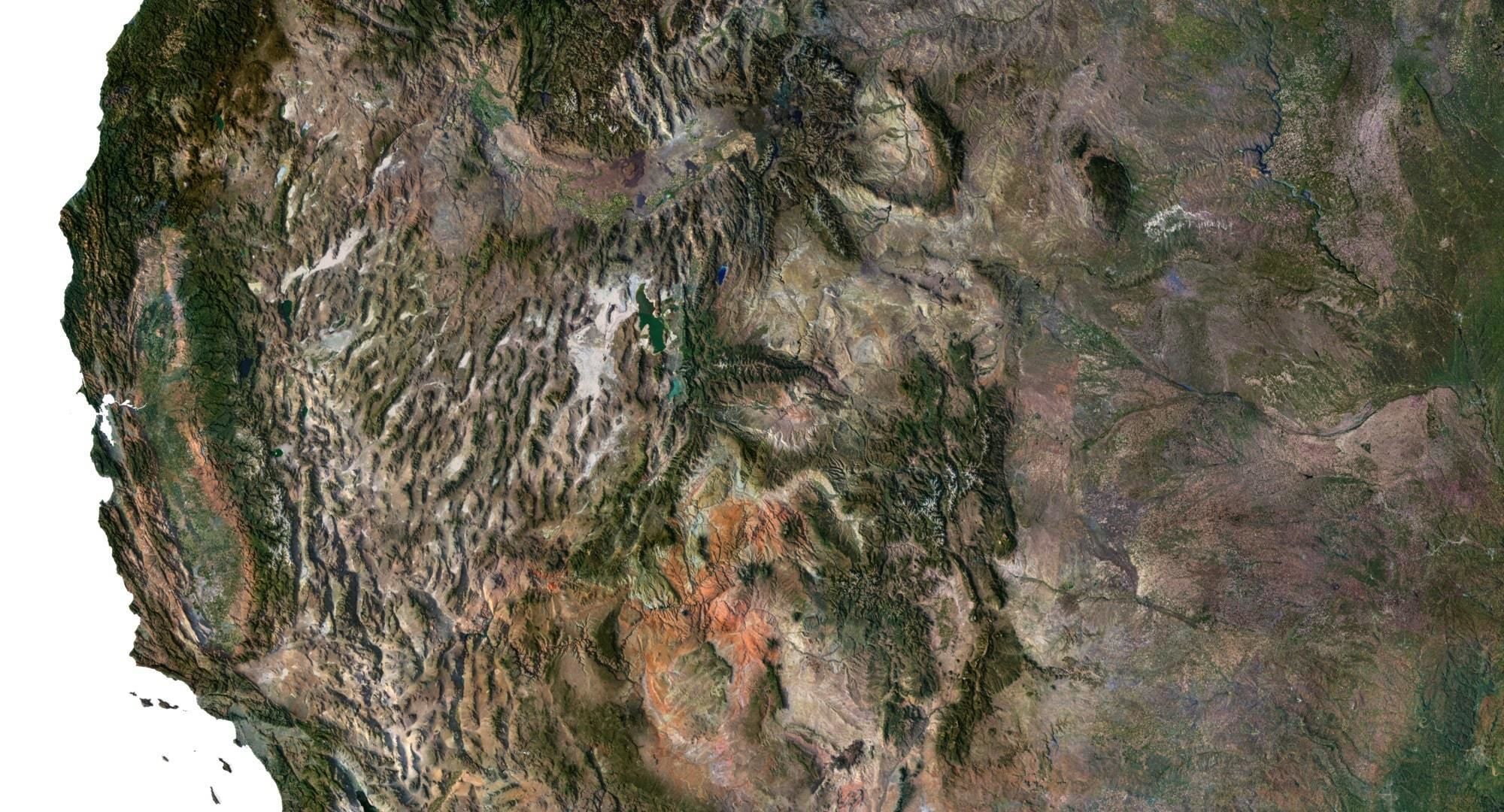
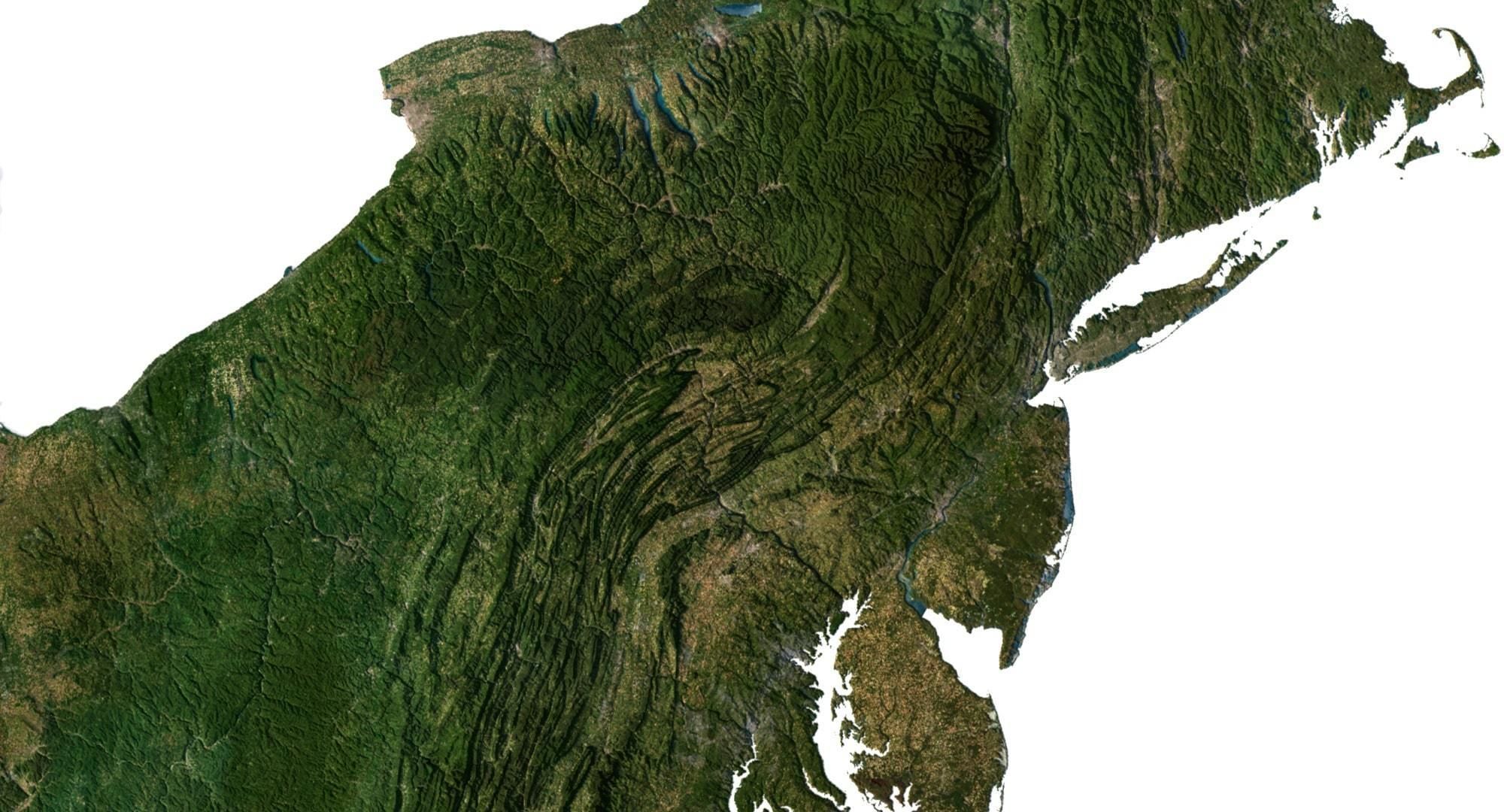
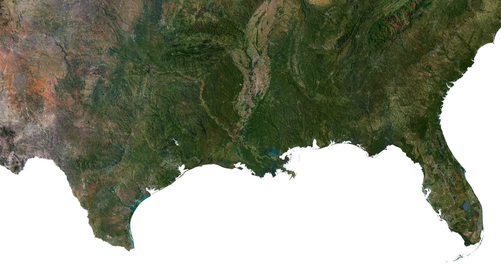
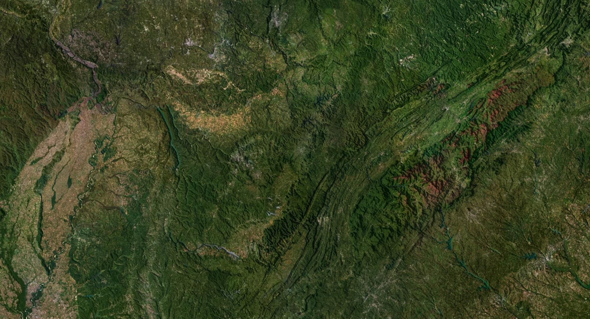
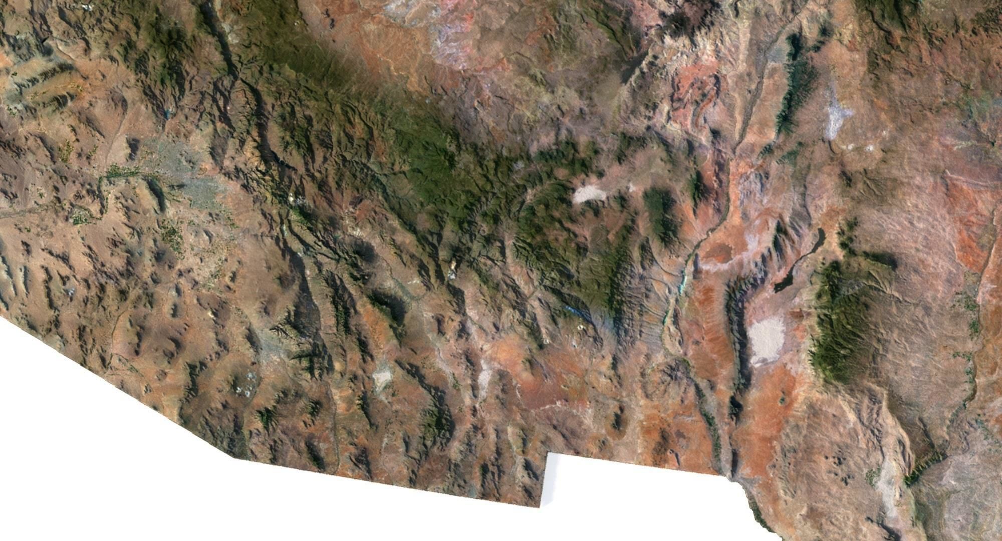
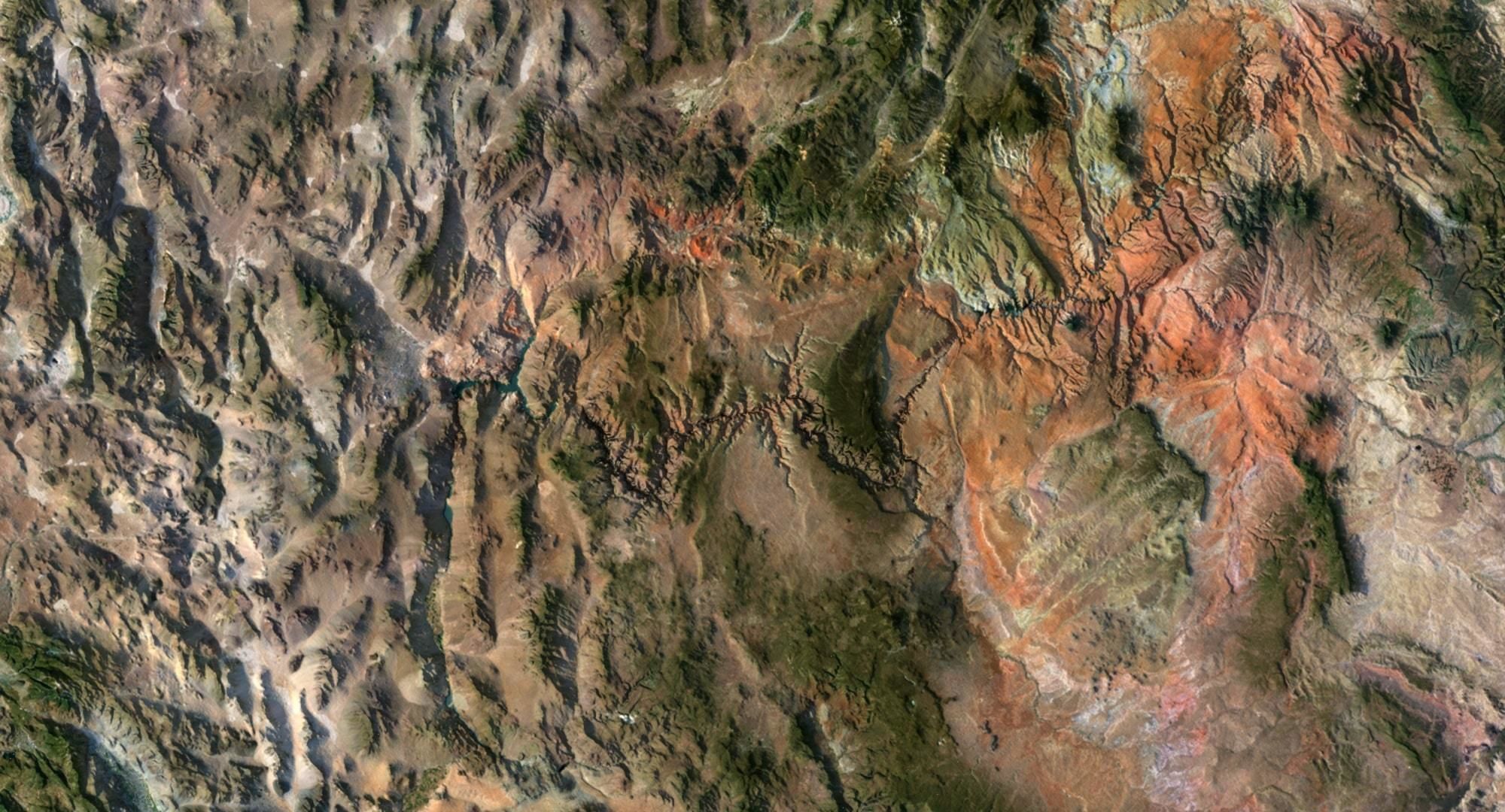
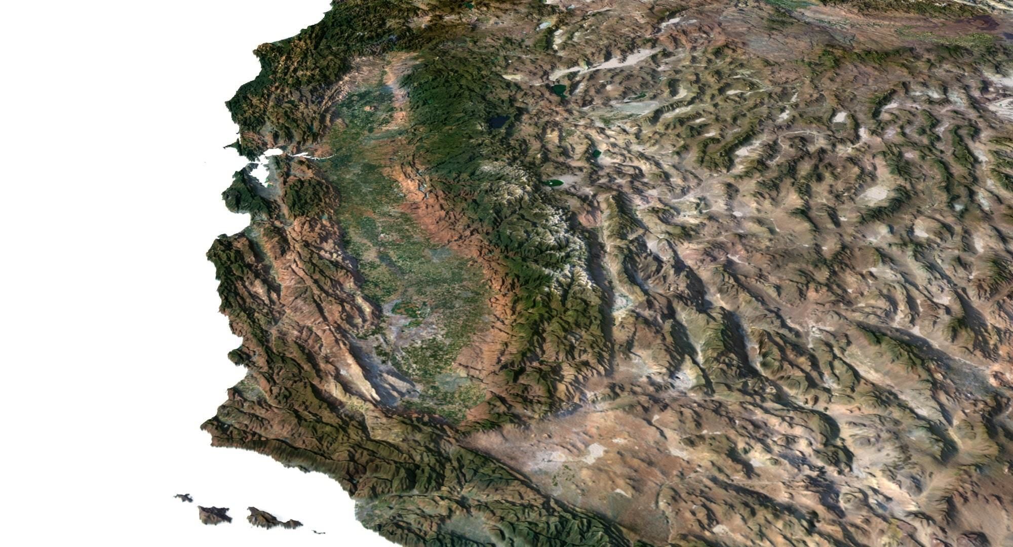
- Satellite Map TIF 9202*6101*48b
- Water Mask TIF 9202*6101*48b - Use this map for masking in the Reflection channel to get glare from the water surface.
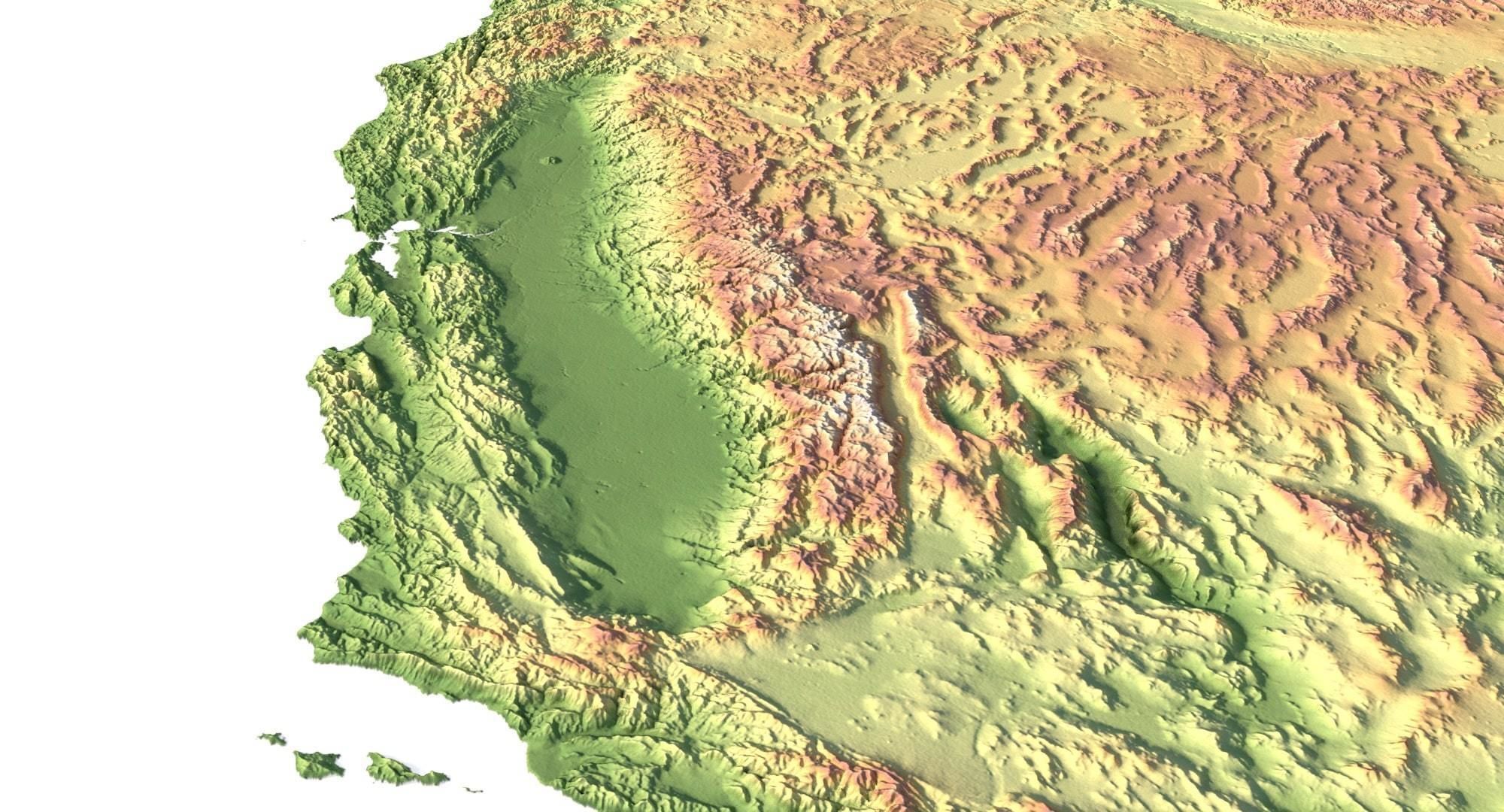
- Pseudo-color Map 9202*6101*48b - Use this map to get elevation information based on the color shade.
- Boundary Mask TIF 9202*6101*48b - Use this map as a mask for your background.
Other models can be made on request.Modifications, conversion to OBJ, FBX, STL and other formats, more detailed models and better textures on request.
United States Terrain 3D Map
Royalty Free License
United States Terrain 3D Map
Royalty Free License

3D Modeling
3D Print Modeling
3D Model formats
Format limitations
Native
- Cinema 4D r23 (.c4d)417 MBVersion: r23Renderer: Default
Exchange
3D Model details
- Publish date2024-06-08
- Model ID#5332688
- Animated
- Rigged
- VR / AR / Low-poly
- PBR
- Geometry Polygon mesh
- Polygons 9,986,310
- Vertices 4,997,720
- Textures
- Materials
- UV Mapping
- Unwrapped UVs Unknown
- Plugins used
- Ready for 3D Printing
Similar Models
to United States Terrain 3D Map

