

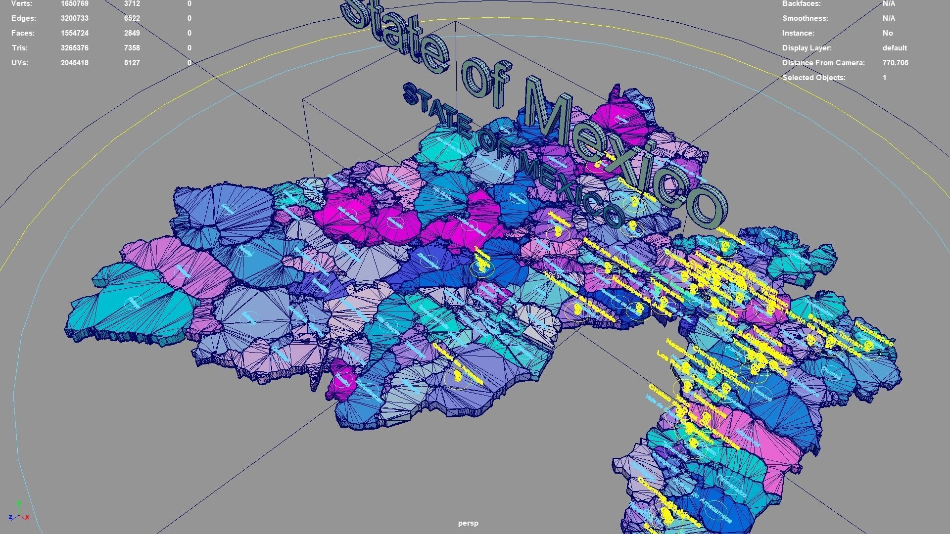

State of Mexico Mexico map region geography political 3D model
The compressed package contains exported fbx.
For the rendering effect of this area, They all have very similar effects, please refer to: https://www.cgtrader.com/gallery/project/model-series-for-sales-map-region-3d-model-geography-political-3d-model-image-rendering-example
If there is a country boundary line in the administrative district, If there is a disputed area, which is the line of actual control, please use it in the country where the administrative district is located and pay attention to inspection.
The map projection is Mercator.
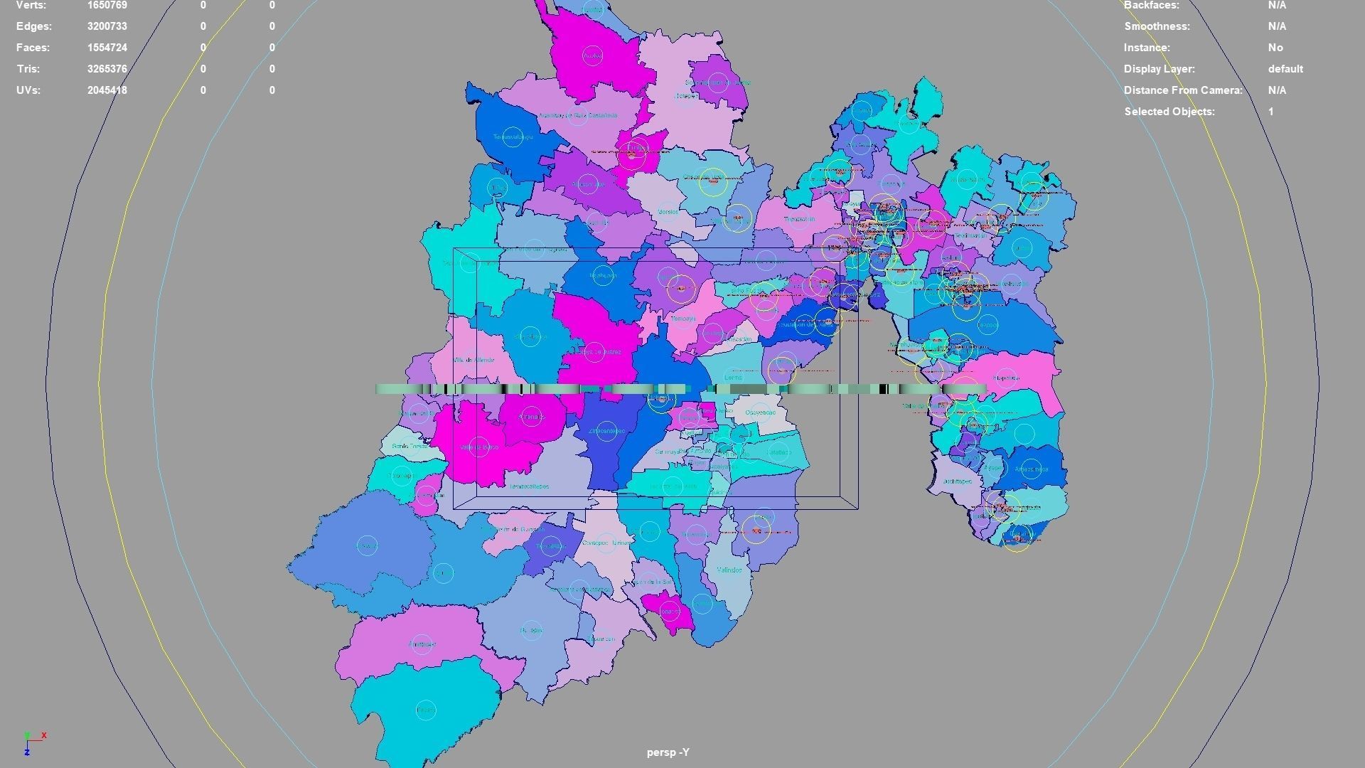
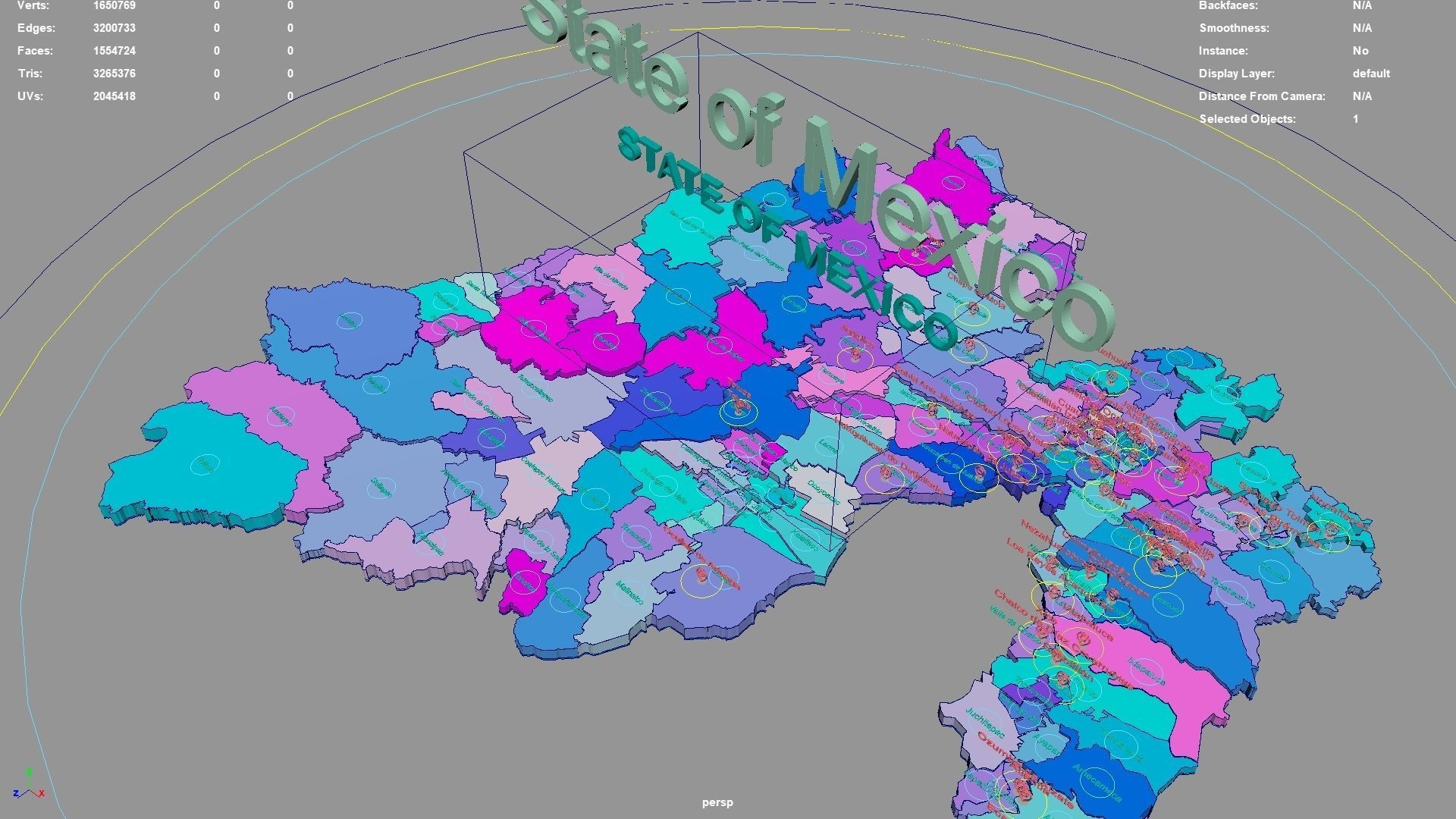
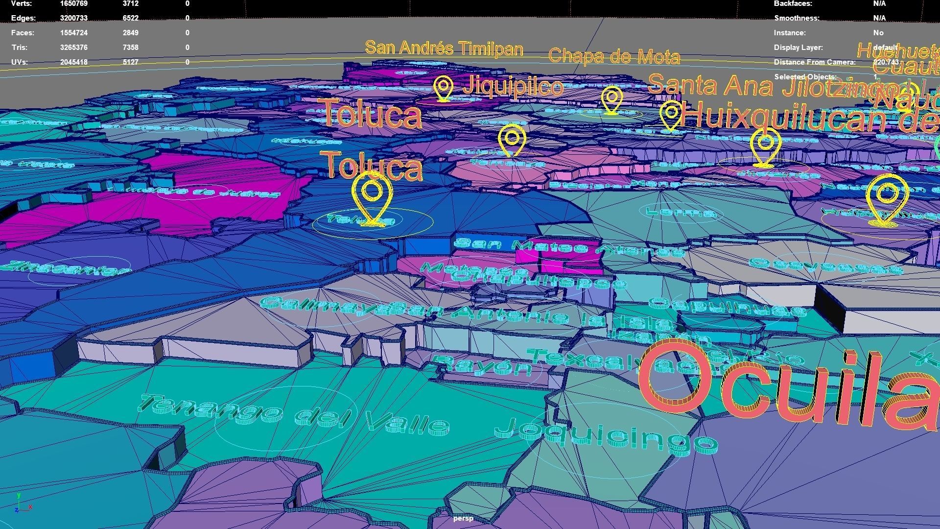
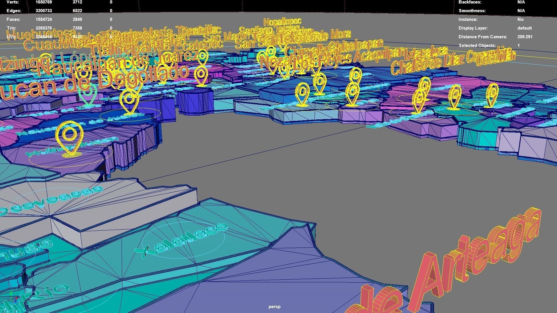
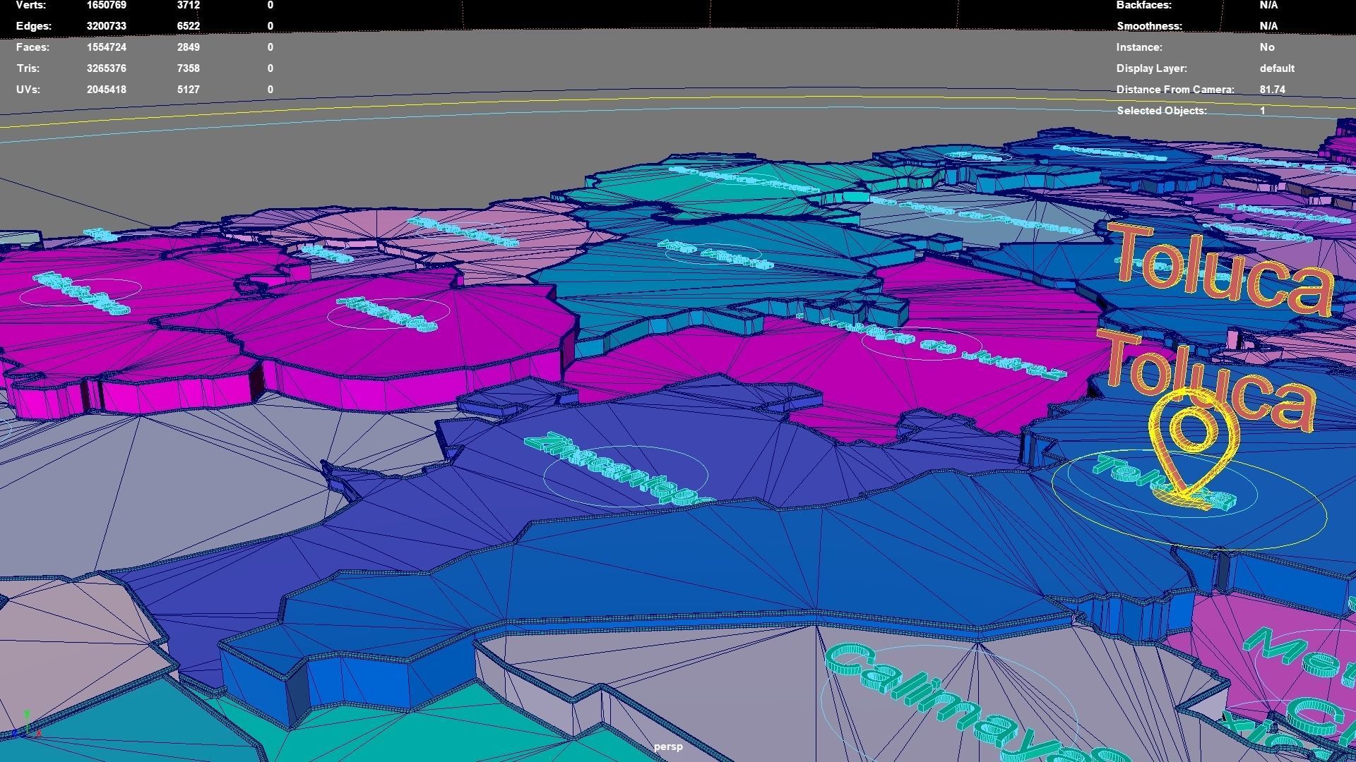
State of Mexico regions : The model is divided according to the administrative region of State of Mexico. Each region is clearly separated so you can easily isolate it or change the colors. Names are also editable and separate.
Model made with maya2023.
Materials applied as seen on renders.
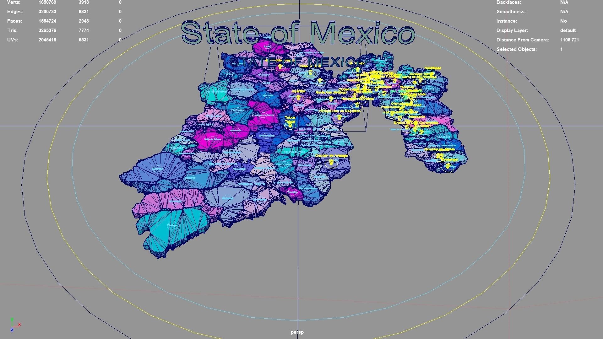
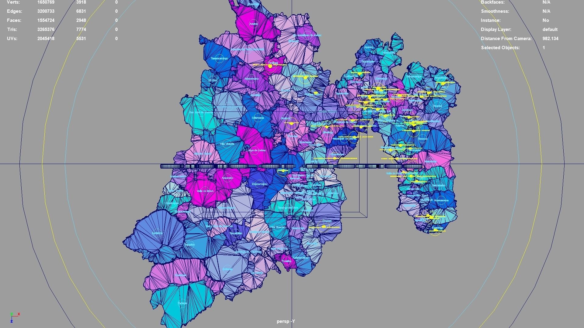
Scene is organized with all mesh named and Uv Unwrapped.
Planar UV mapped from above.
Directly below the map icon is the government location of the administrative district (not manually placed, but generated using a program based on latitude and longitude. The boundaries of the administrative district are also automatically generated by the program based on the administrative district).The administrative division and government location data were downloaded from OSM in 2023, but the data may not have been updated in 2023.The data in administrative regions is diverse and frequently changing, with potential omissions, errors, and inability to troubleshoot one by one. If your requirements are strict, you can check them yourself.
If the file uses a map, after opening the maya file, specify the map path yourself.
If there is a binding of place names, the binding details is as follows: The small curve circle below the 3D font can control the transformation of the 3D font and 3D map icon directly above (moving, rotating, scaling); 3D fonts and 3D map icons can be transformed independently. Except for the outermost large curve circle, all inner large curve circles control the overall transformation of different categories of 3D fonts and 3D map icons. The outermost curve circle controls the overall transformation of all objects.
This file retains historical records and does not collapse. The 3D font is easily adjusted.
If the extruded sweep polygonal faces are interspersed, you can press the 3 key in Maya to start smoothing, which can improve this situation. Alternatively, modify the parameters of the corresponding sweepMeshCreator node, such as changing the Interpolation Mode to Precision.
For UV snapshot, please refer to Preview images on this page.
Rendering:
Maya default renderer: arnold 5.2.1.1.
The model material is blinn.
The arnold renderer is selected for installation by default when installing maya2023.
State of Mexico, MexicoEstado de México, México.
State of Mexico division:Tonanitla,Temascalapa,Metepec,Tlalnepantla de Baz,Tonatico,Santo Tomás,Isidro Fabela,Toluca,Ayapango,Ixtapaluca,Chicoloapan,Timilpan,Zumpango,Naucalpan de Juárez,Soyaniquilpan de Juárez,Amanalco,Nextlalpan,Jiquipilco,Temoaya,San José del Rincón,Otzolotepec,Papalotla,Tejupilco,Apaxco,Xonacatlán,Almoloya del Río,Tenango del Valle,Valle de Bravo,Chapultepec,Atenco,Ixtapan del Oro,Atizapán de Zaragoza,Temascaltepec,San Antonio la Isla,Villa Victoria,Cuautitlán Izcalli,Calimaya,Coyotepec,Temamatla,Morelos,Ocoyoacac,Tlatlaya,Villa del Carbón,Atlacomulco,Atlautla,Polotitlán,Teoloyucan,Mexicaltzingo,Cuautitlán,Malinalco,El Oro,Texcaltitlán,Hueypoxtla,Jocotitlán,Rayón,Zinacantepec,Joquicingo,Teotihuacán,Acambay de Ruíz Castañeda,San Simón de Guerrero,Chiautla,Aculco,Lerma,Nopaltepec,Ocuilan,Tepetlixpa,Tlalmanalco,Coatepec Harinas,Zacualpan,Otumba,Ixtapan de la Sal,Ecatzingo,Tianguistenco,Tenancingo,Valle de Chalco Solidaridad,Almoloya de Juárez,Donato Guerra,Sultepec,Huixquilucan,Juchitepec,Amatepec,Chalco,Chimalhuacán,Huehuetoca,Xalatlaco,Villa de Allende,Ecatepec de Morelos,Ixtlahuaca,Cocotitlán,Nicolás Romero,Capulhuac,Atizapán,Axapusco,Chiconcuac,Tultepec,San Mateo Atenco,Nezahualcóyotl,Jilotzingo,Chapa de Mota,Otzoloapan,Luvianos,Melchor Ocampo,Tepetlaoxtoc,Villa Guerrero,Jilotepec,Almoloya de Alquisiras,Zacazonapan,San Felipe del Progreso,Tenango del Aire,San Martín de las Pirámides,Ozumba,Zumpahuacán,Texcoco,Temascalcingo,Tultitlán,Tepotzotlán,Jaltenco,State of Mexico,Tecámac,Texcalyacac,La Paz,Tezoyuca,Coacalco de Berriozábal,Amecameca,Tequixquiac,Acolman.
State of Mexico, Mexico .map,region,geography,political,geographic,administrative division,city Landscape,3D model.
division_name:State_of_Mexico_L4_6_1376489.
Similar Models

Users who bought this item also bought...
