


Useto navigate. Pressescto quit
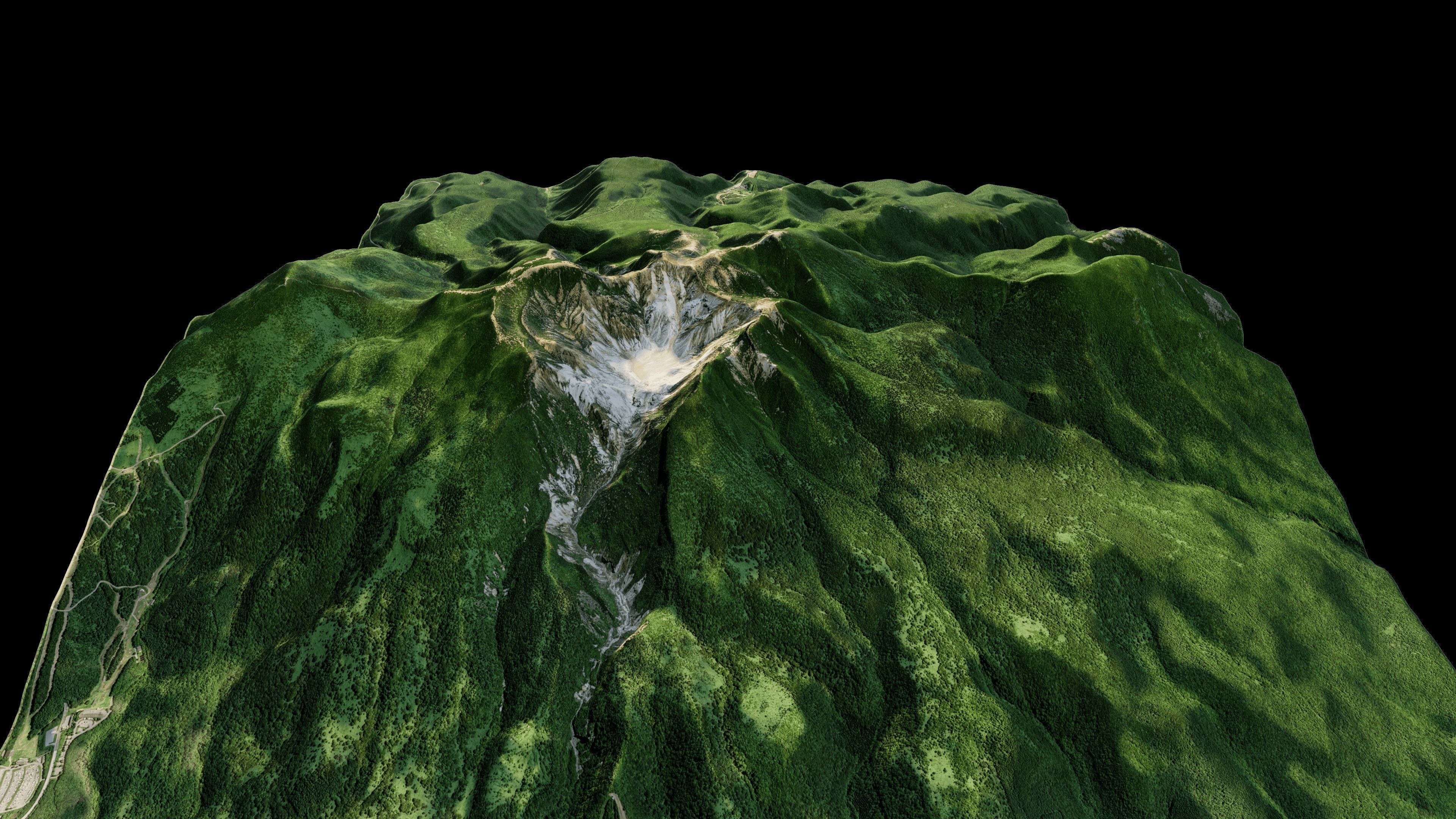
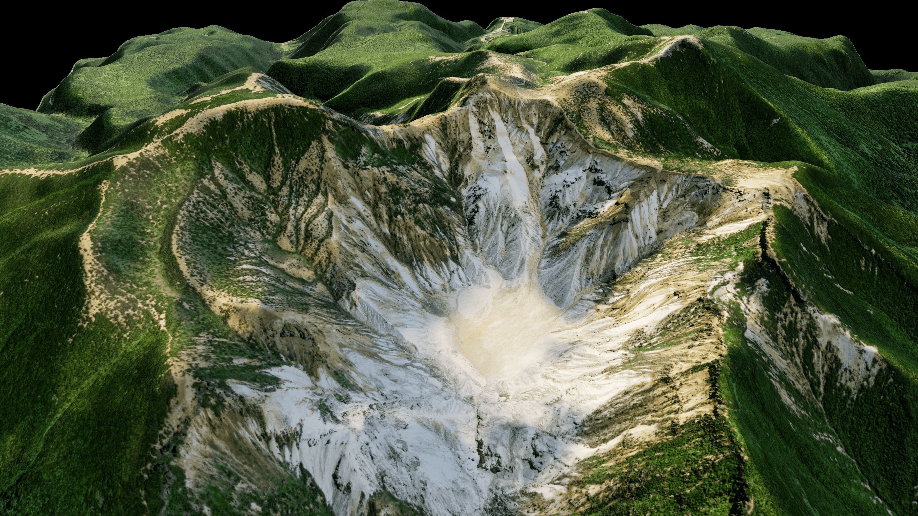
Mount Adatara 3d model terrain 3D model
Description
Mount Adatara 3d model terrain. 3d model landscape of the Adatara stratovolcano.
3d model landscape of Mount Adatara, Kuromori Atamimachi Ishimushiro, Koriyama, Fukushima, Japan.
High Poly meshHigh detailed model
with 8K textures
- Diffuse map
- AO map
- Displacement map
- Normal map
- Roughness map
The Blend file do not require the displacement, but you can still use it if you want to create other model yourself
texture example from the CMount Adatara, Kuromori Atamimachi Ishimushiro, Koriyama, Fukushima, Japan. Mount Adatara is a stratovolcano in Fukushima Prefecture, Japan. It is located about 15 kilometres southwest of the city of Fukushima and east of Mount Bandai. Its last known eruption was in 1996. An eruption in 1900 killed 72 workers at a sulfur mine located in the summit crater.
Similar Models
to Mount Adatara 3d model terrain

Users who bought this item also bought...
