


Biohazard Wasteland Multipurpose 3D Terrain Model 3D model
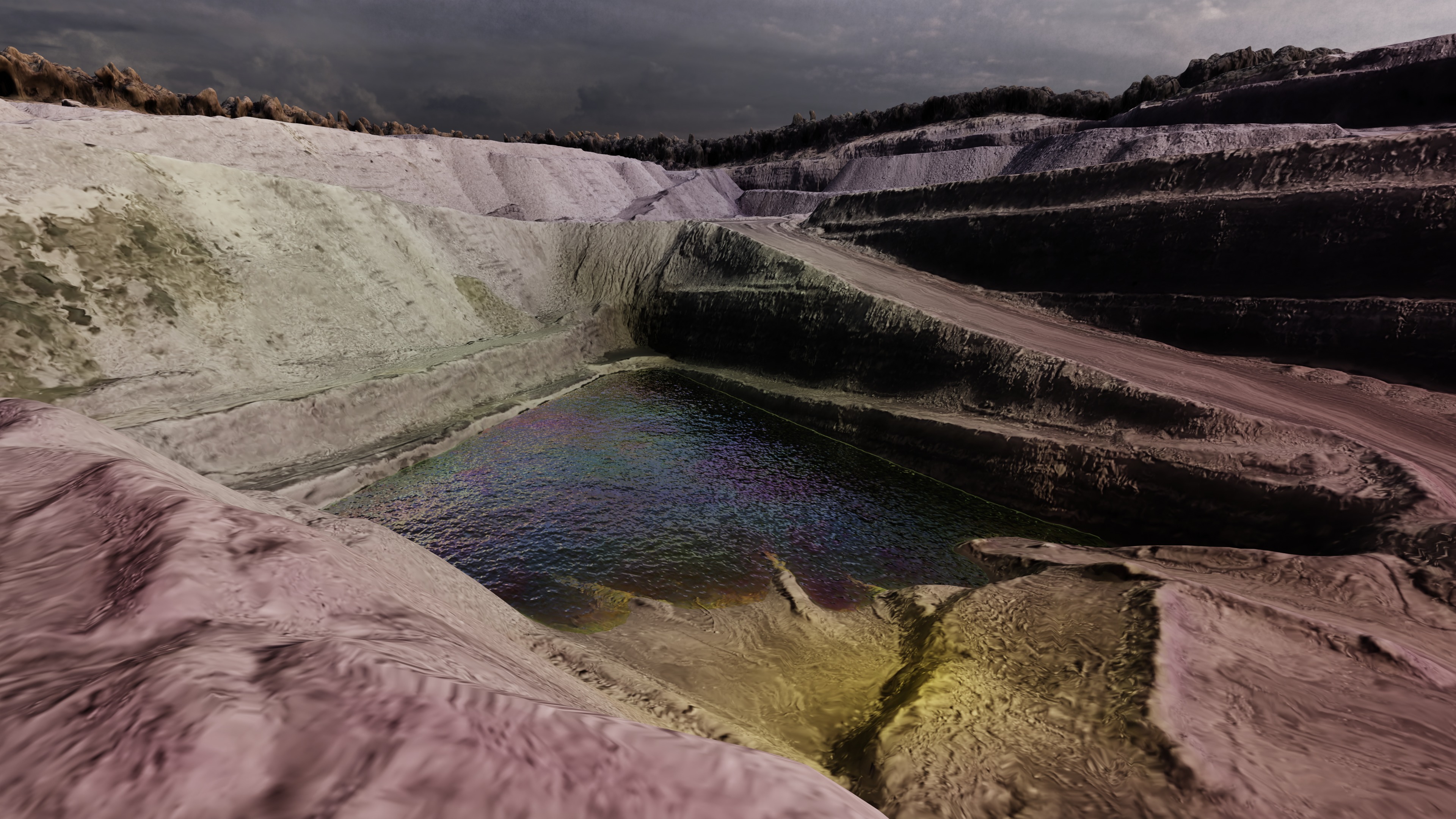
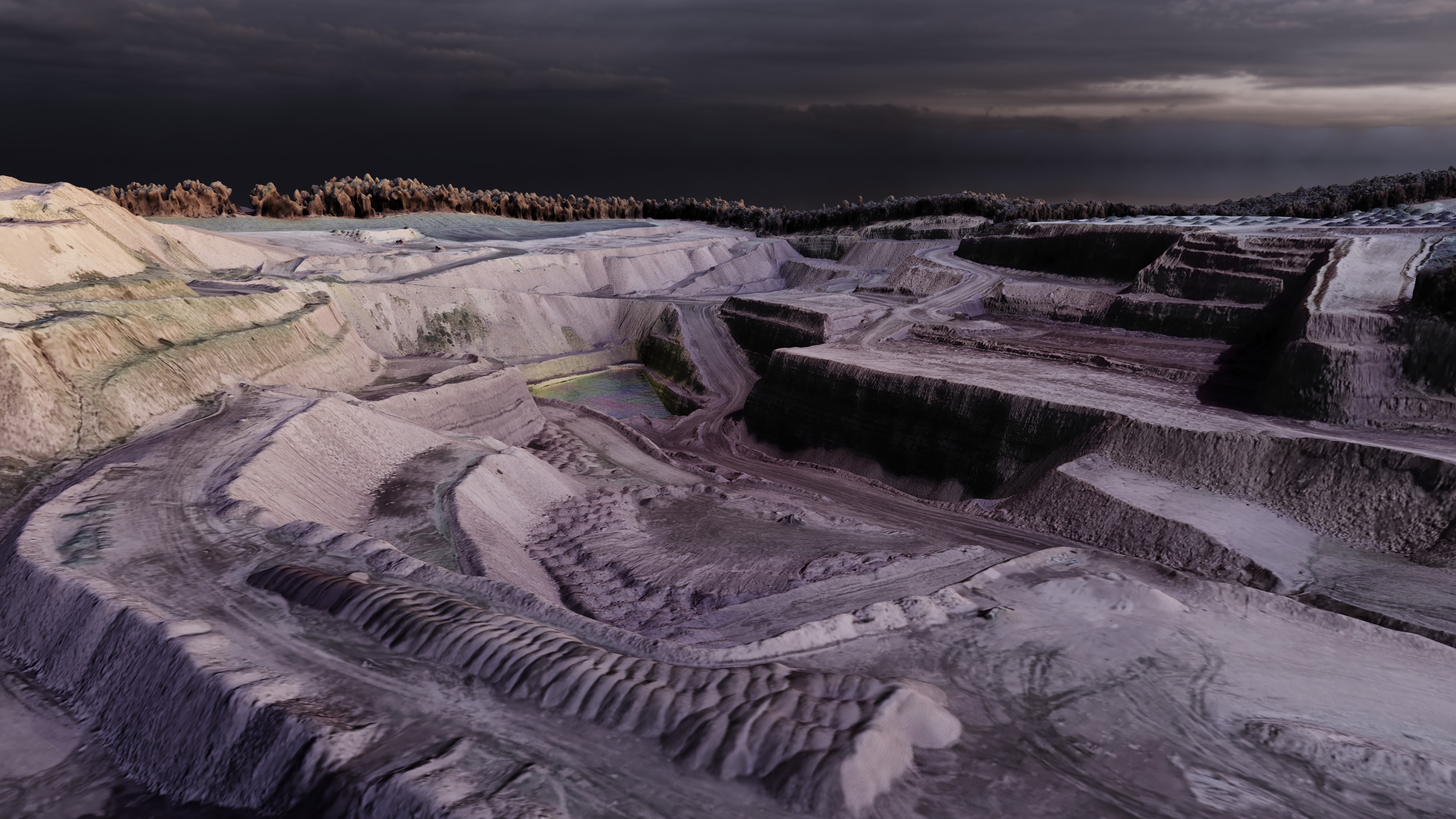
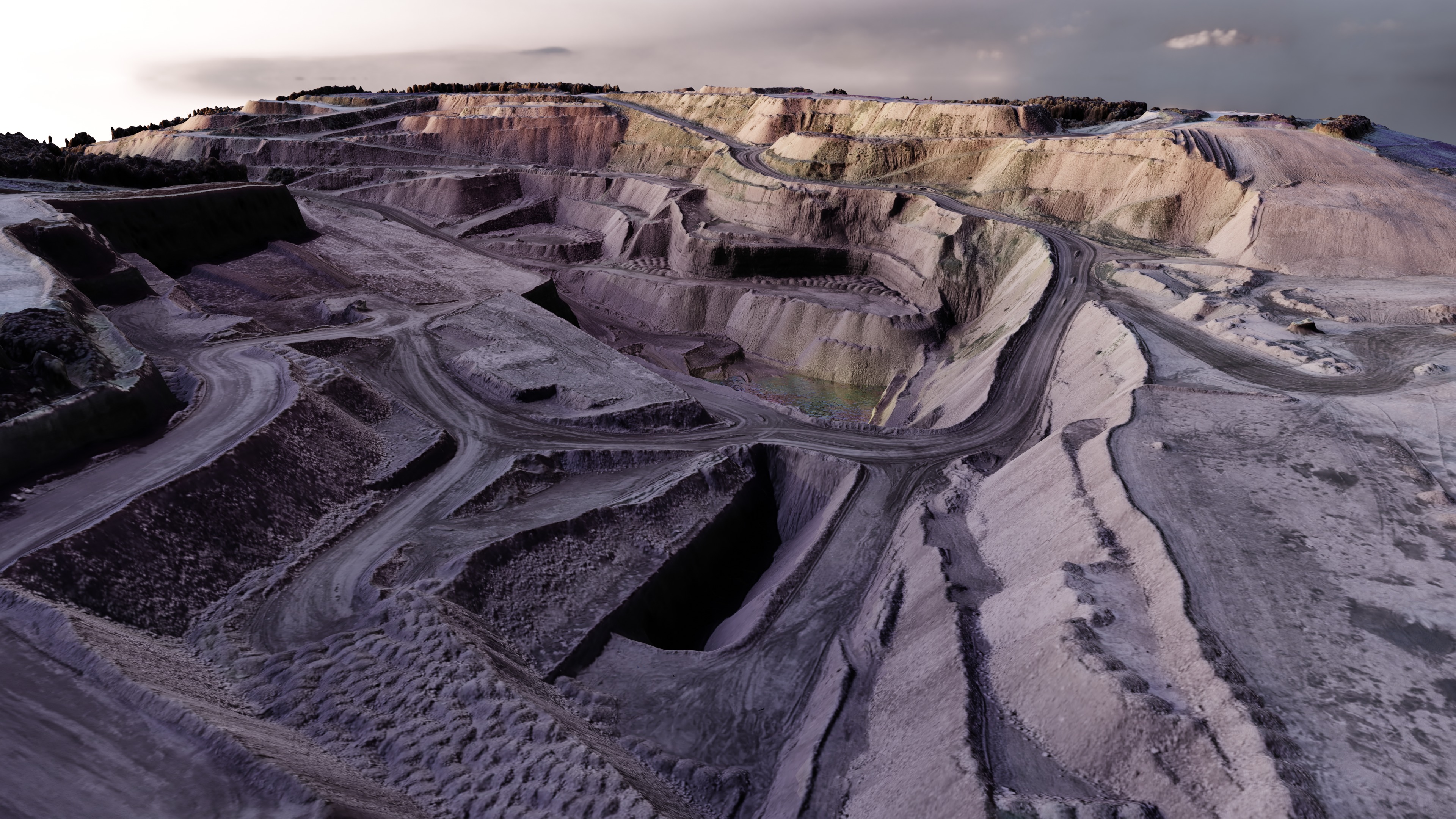
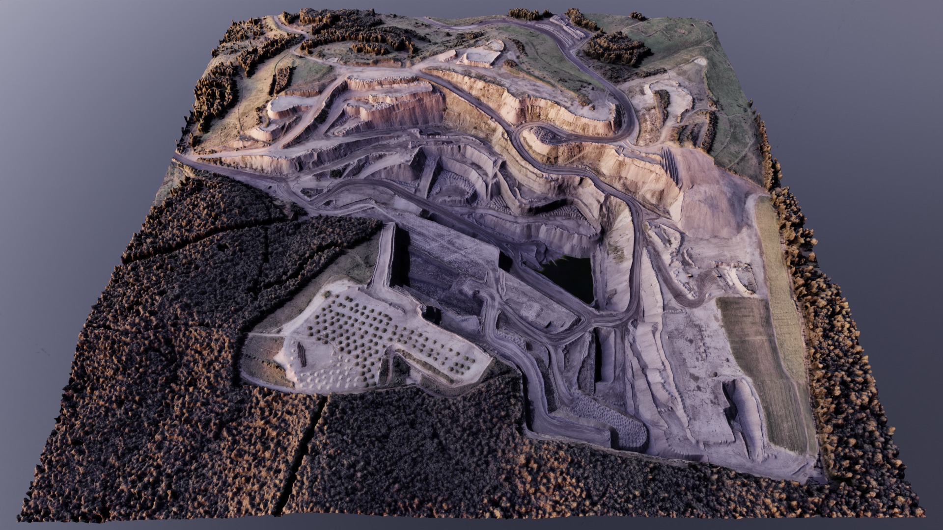
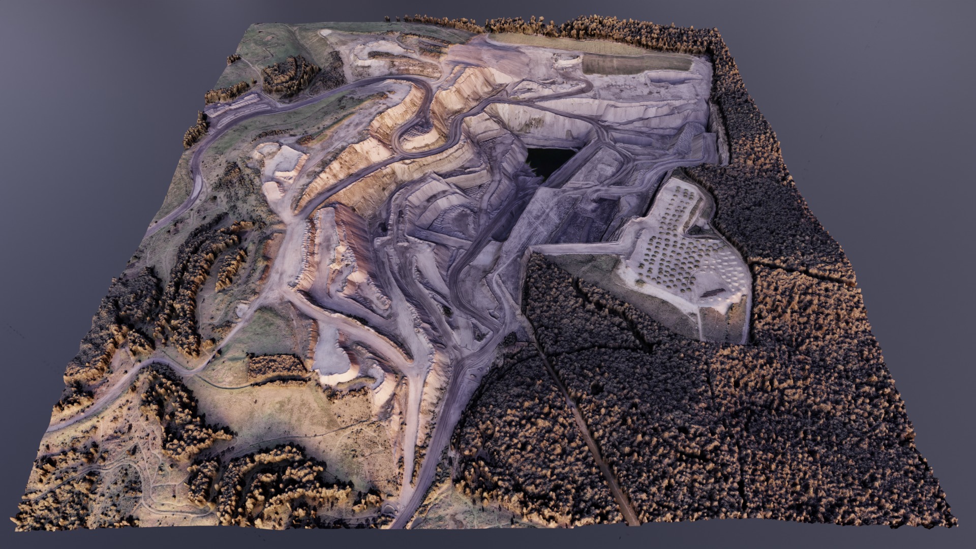
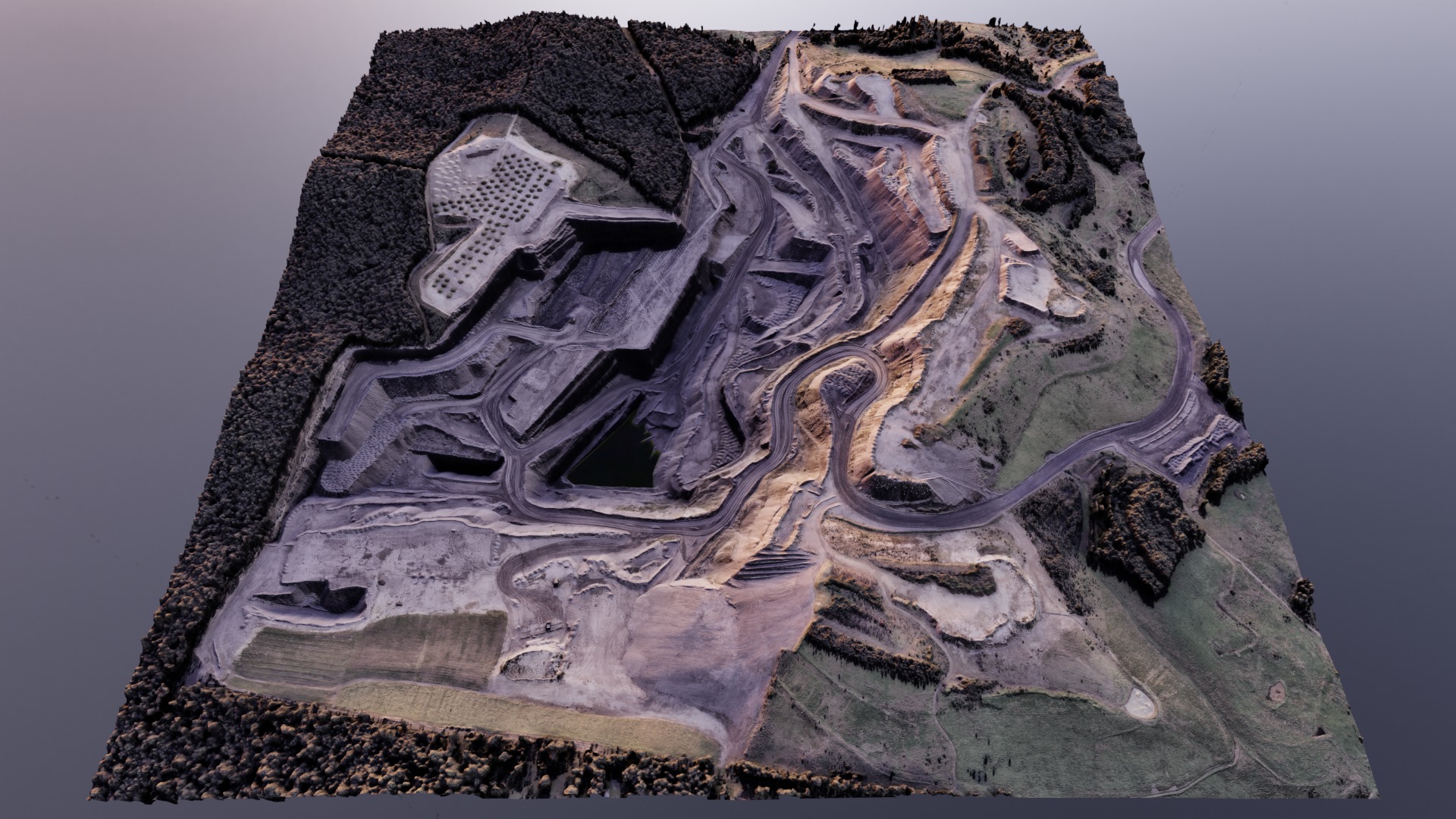
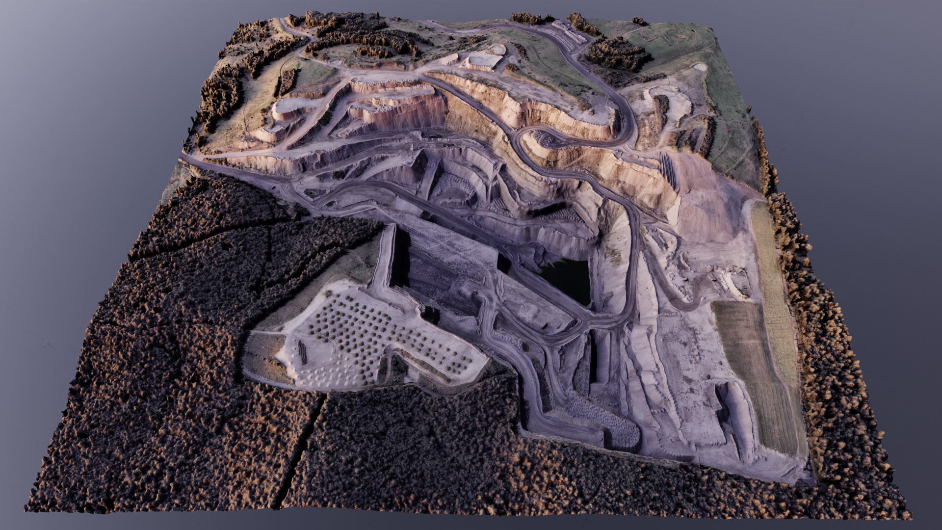
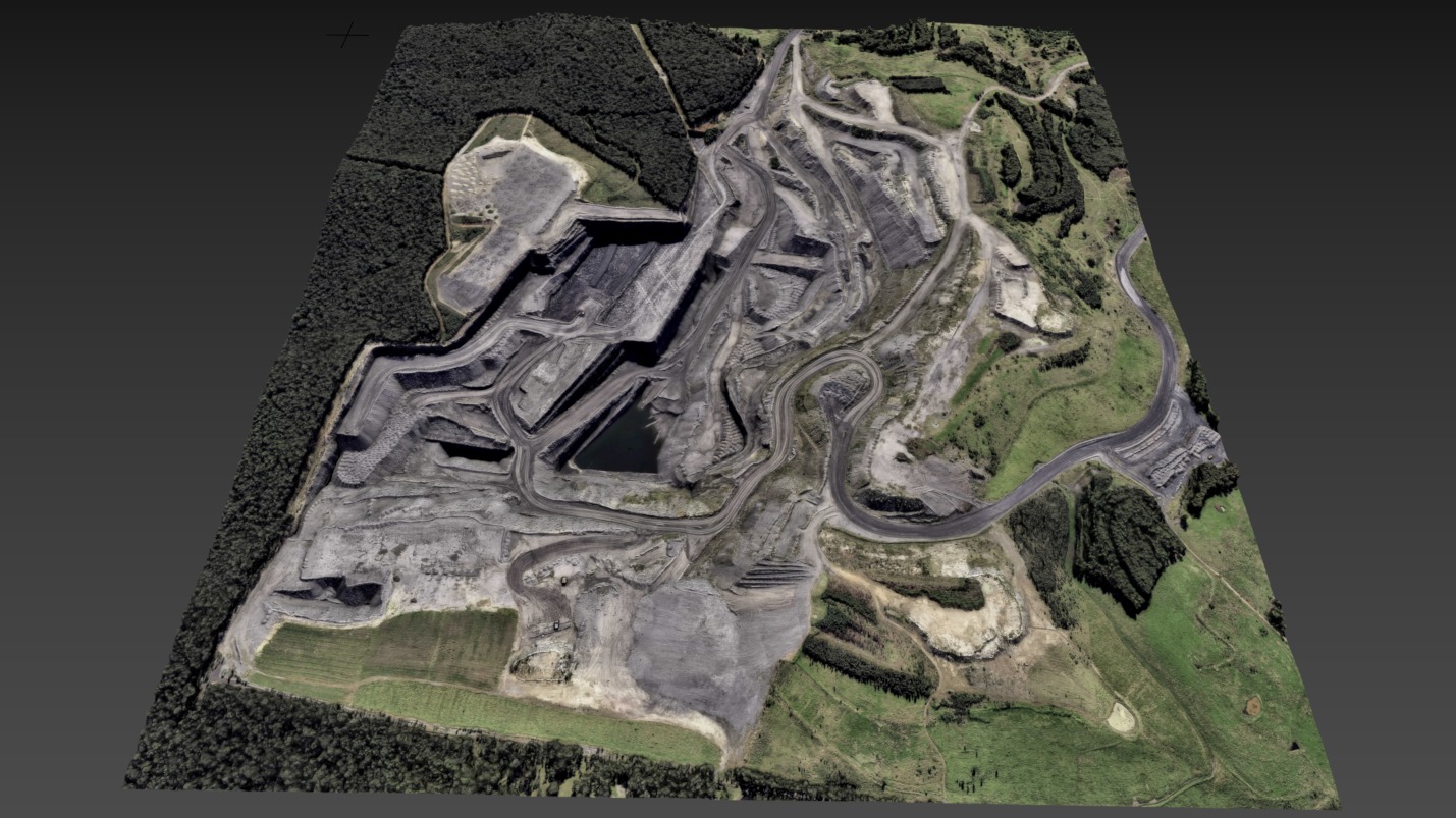
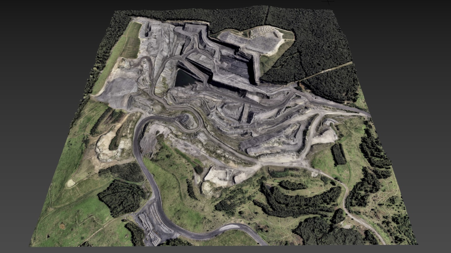
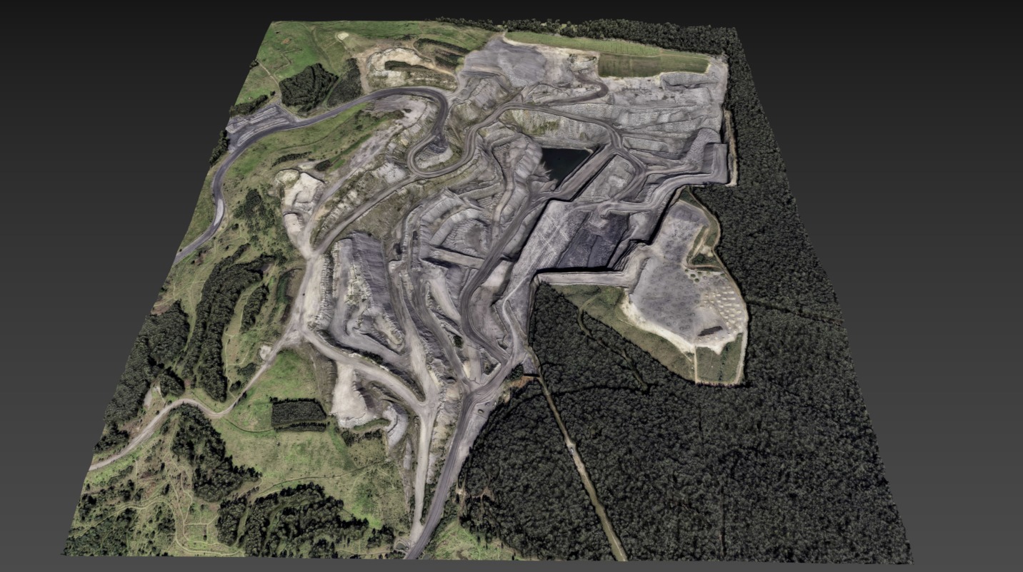
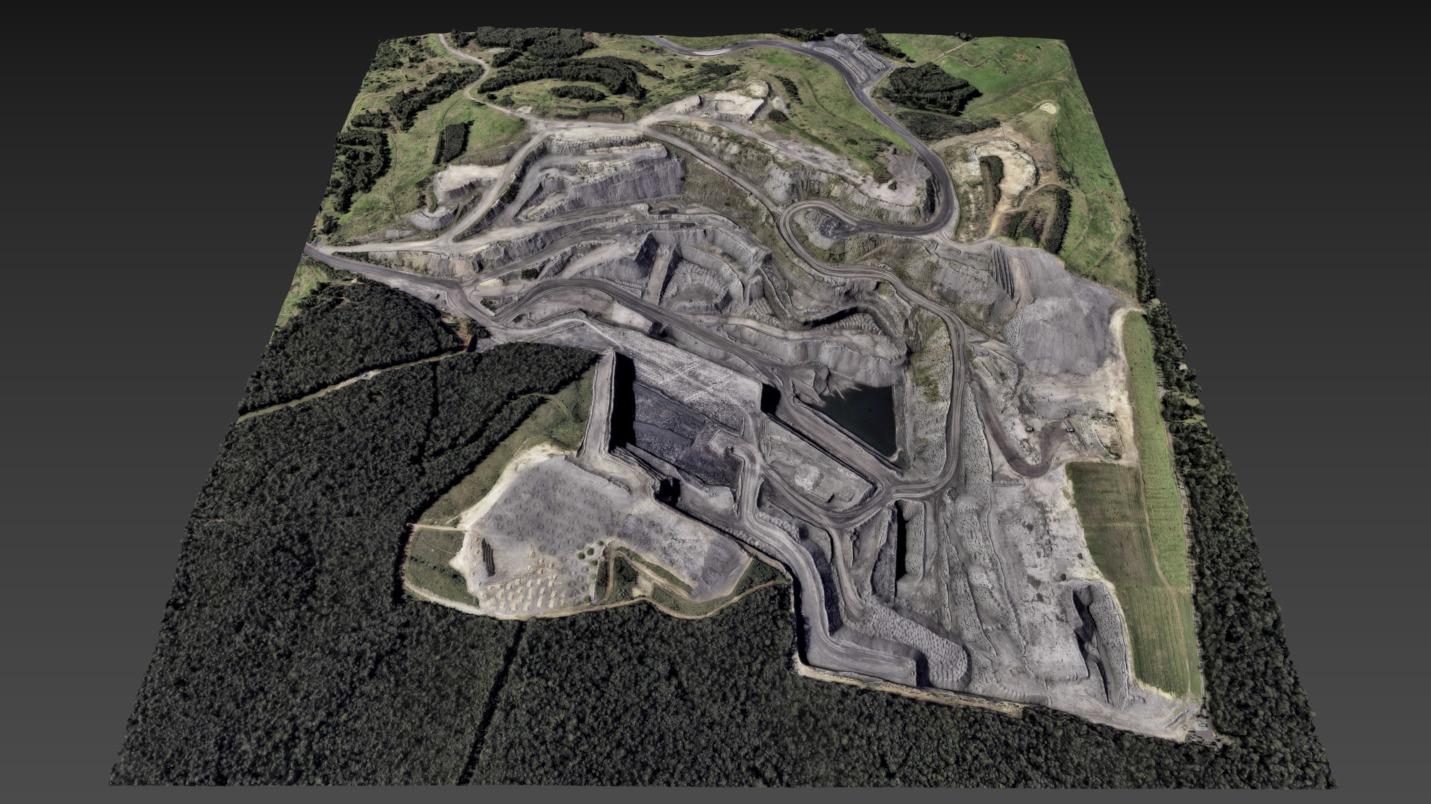
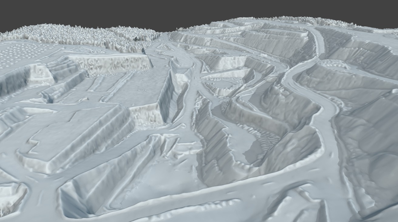
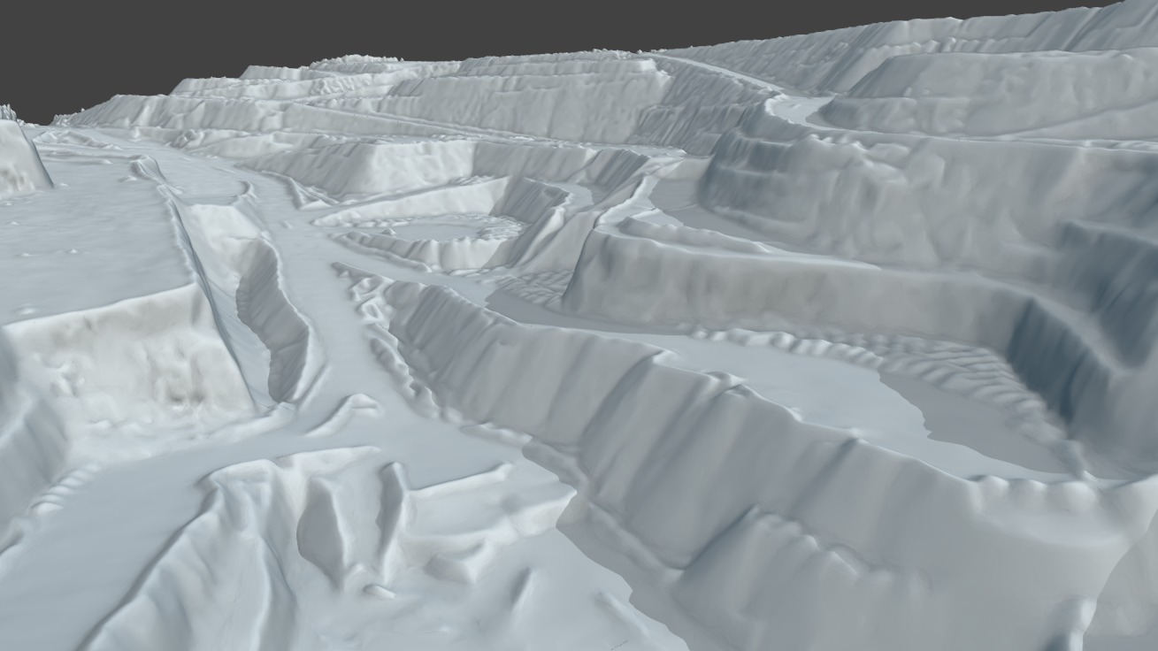
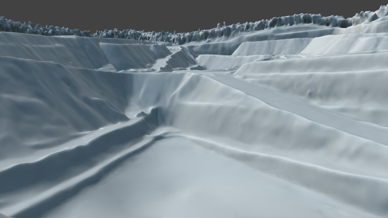
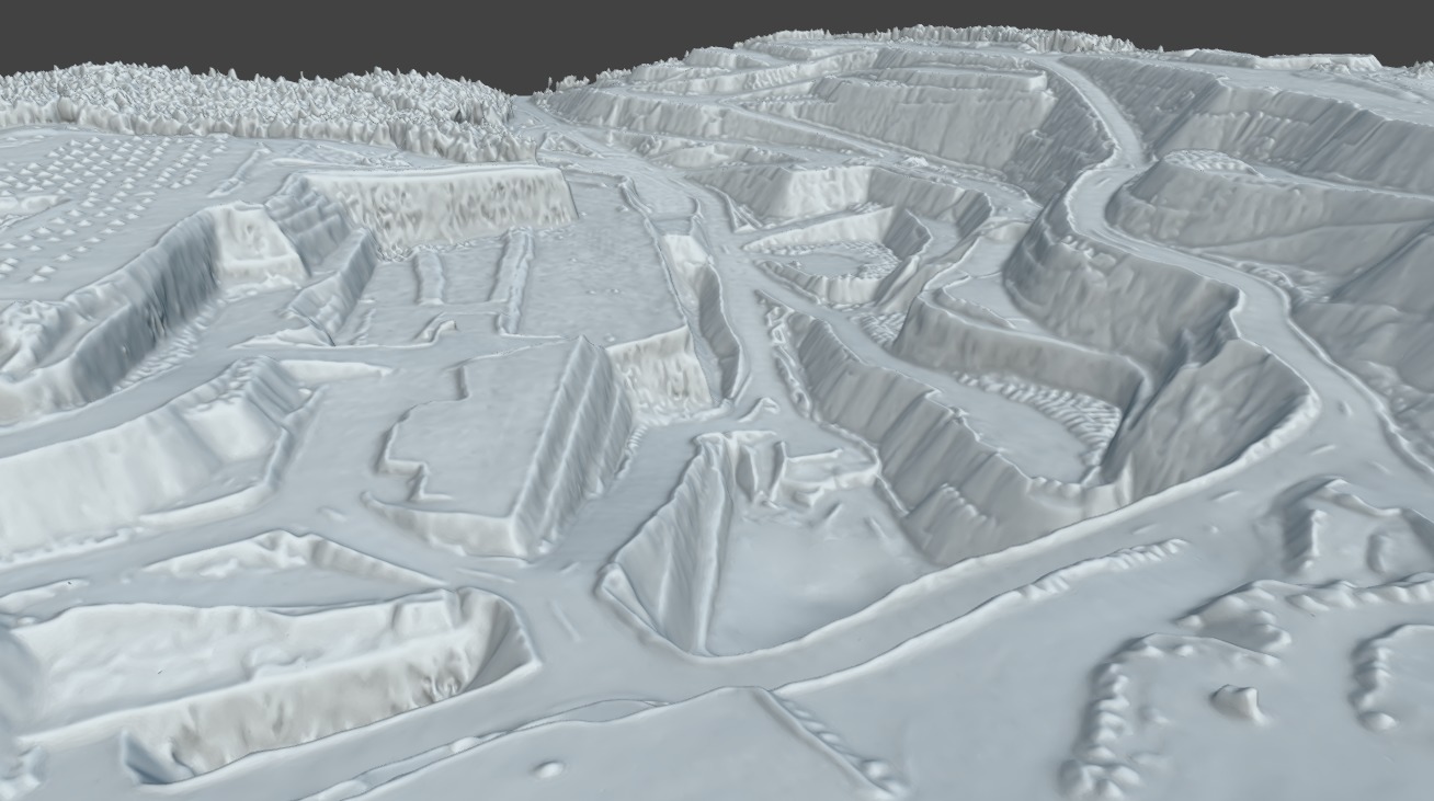
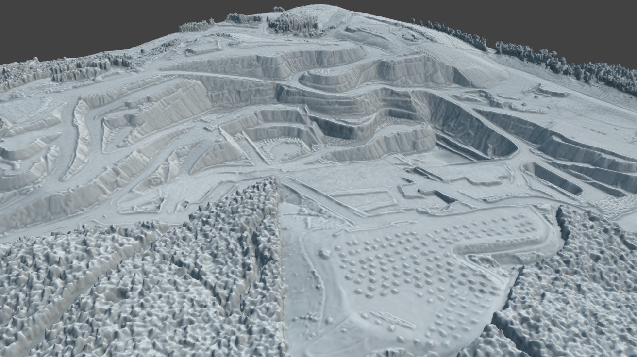
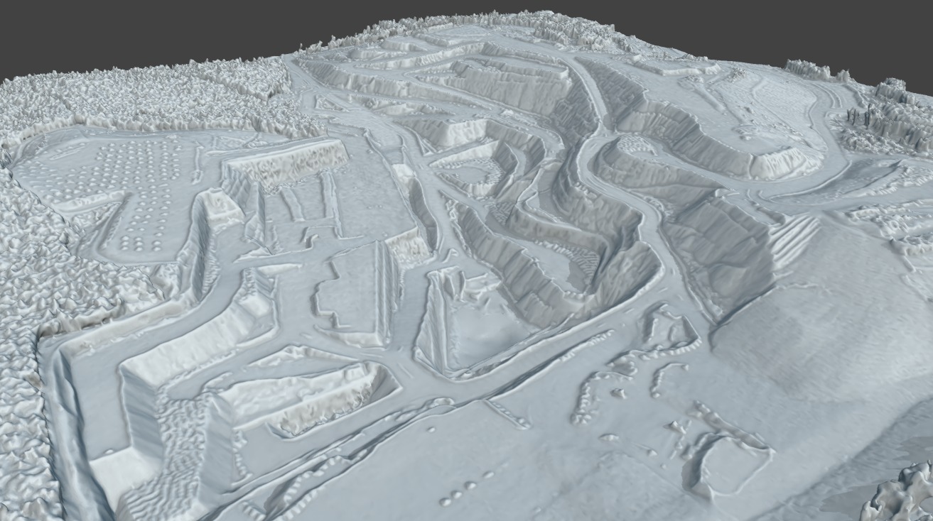
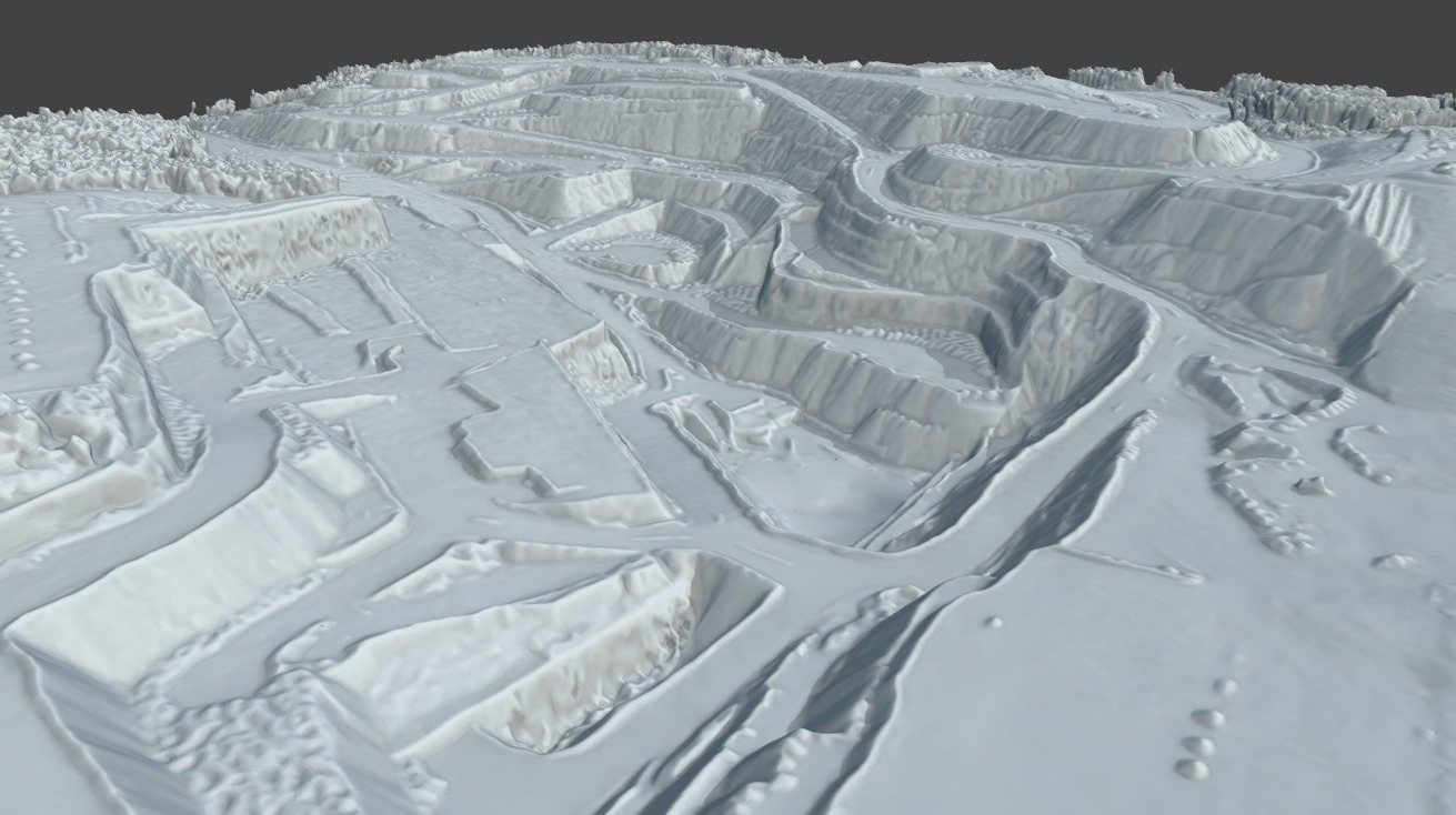
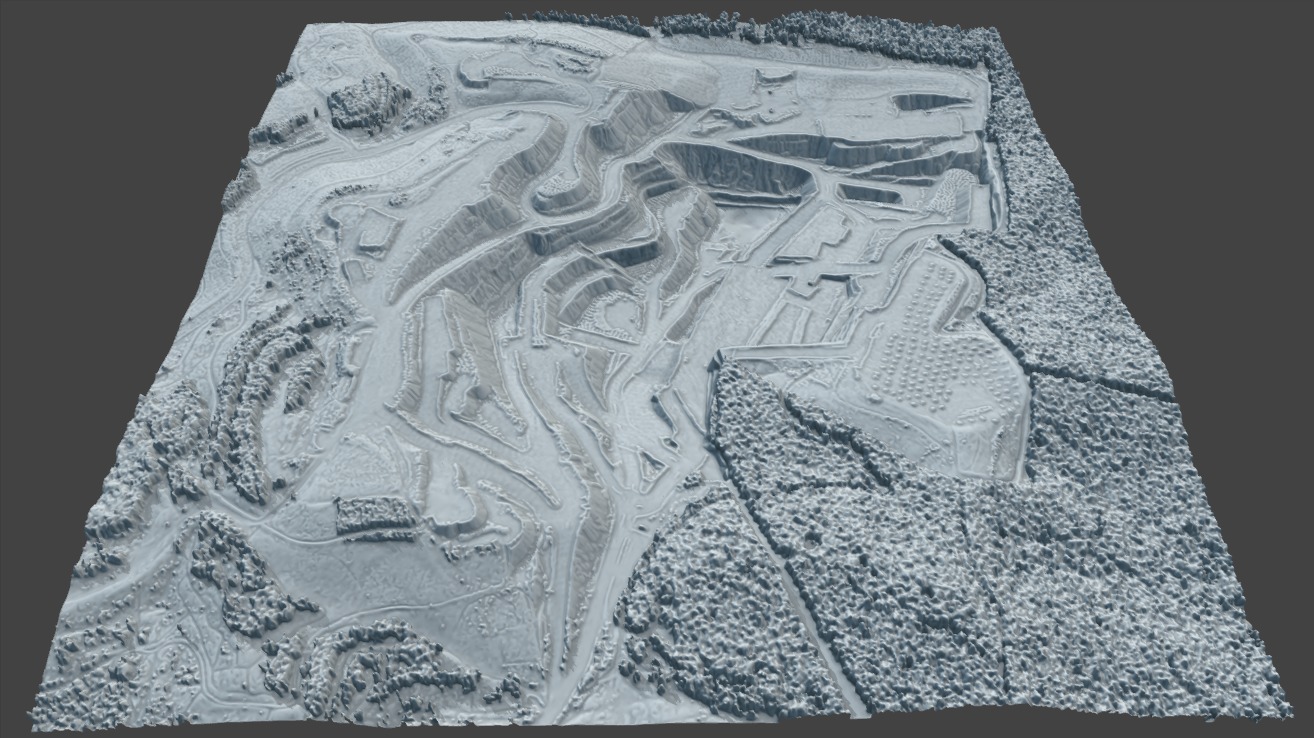
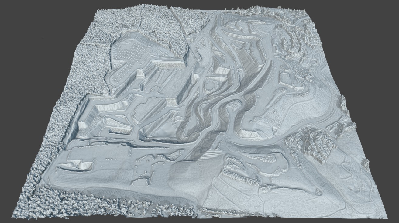
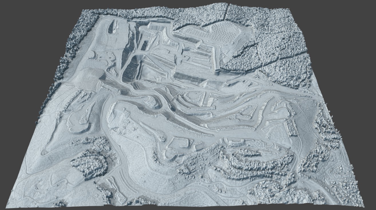
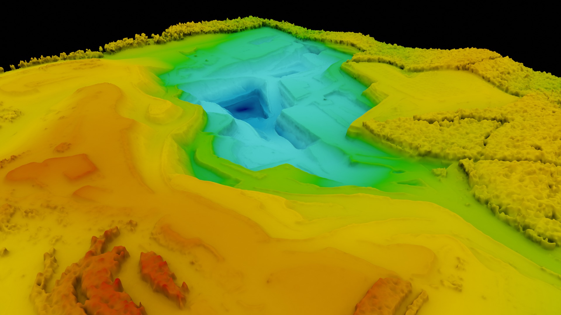
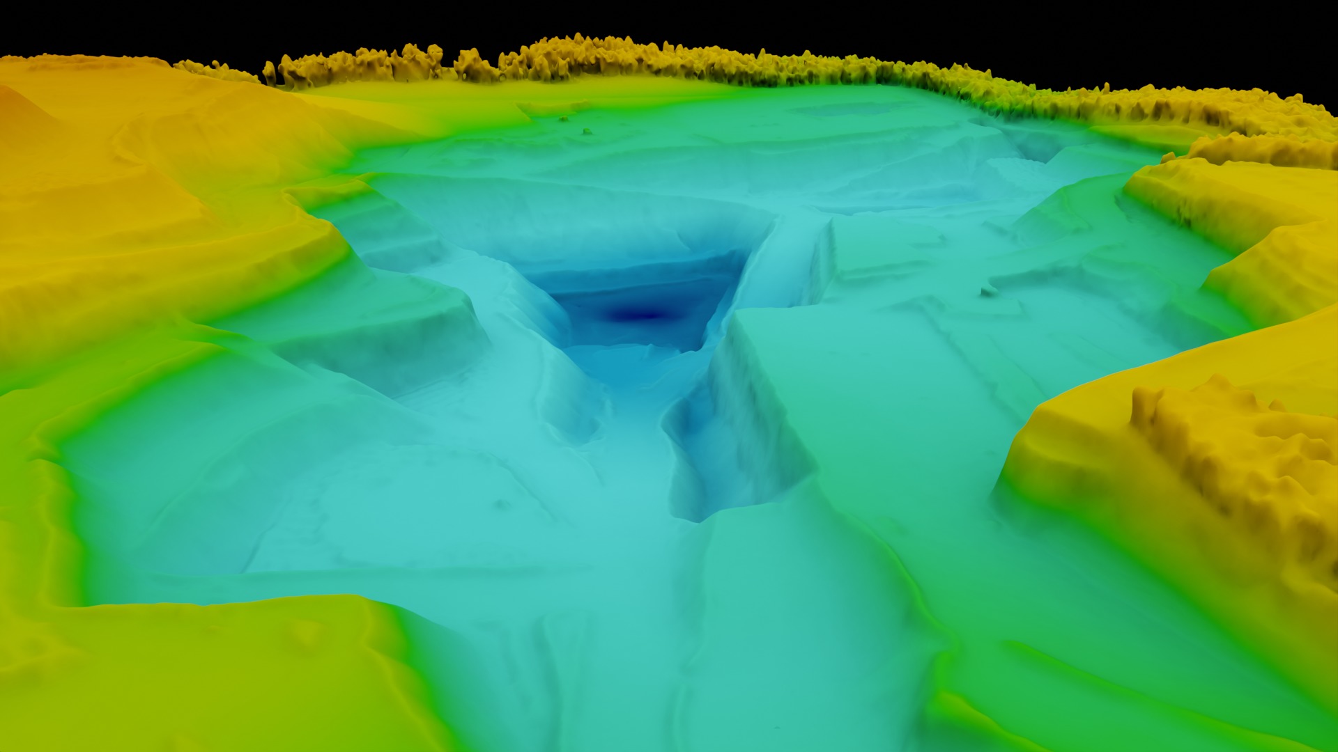
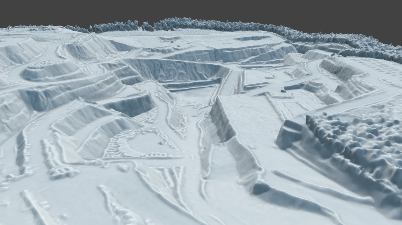
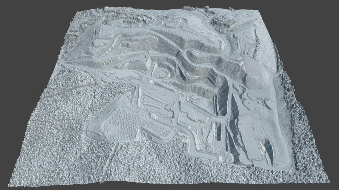
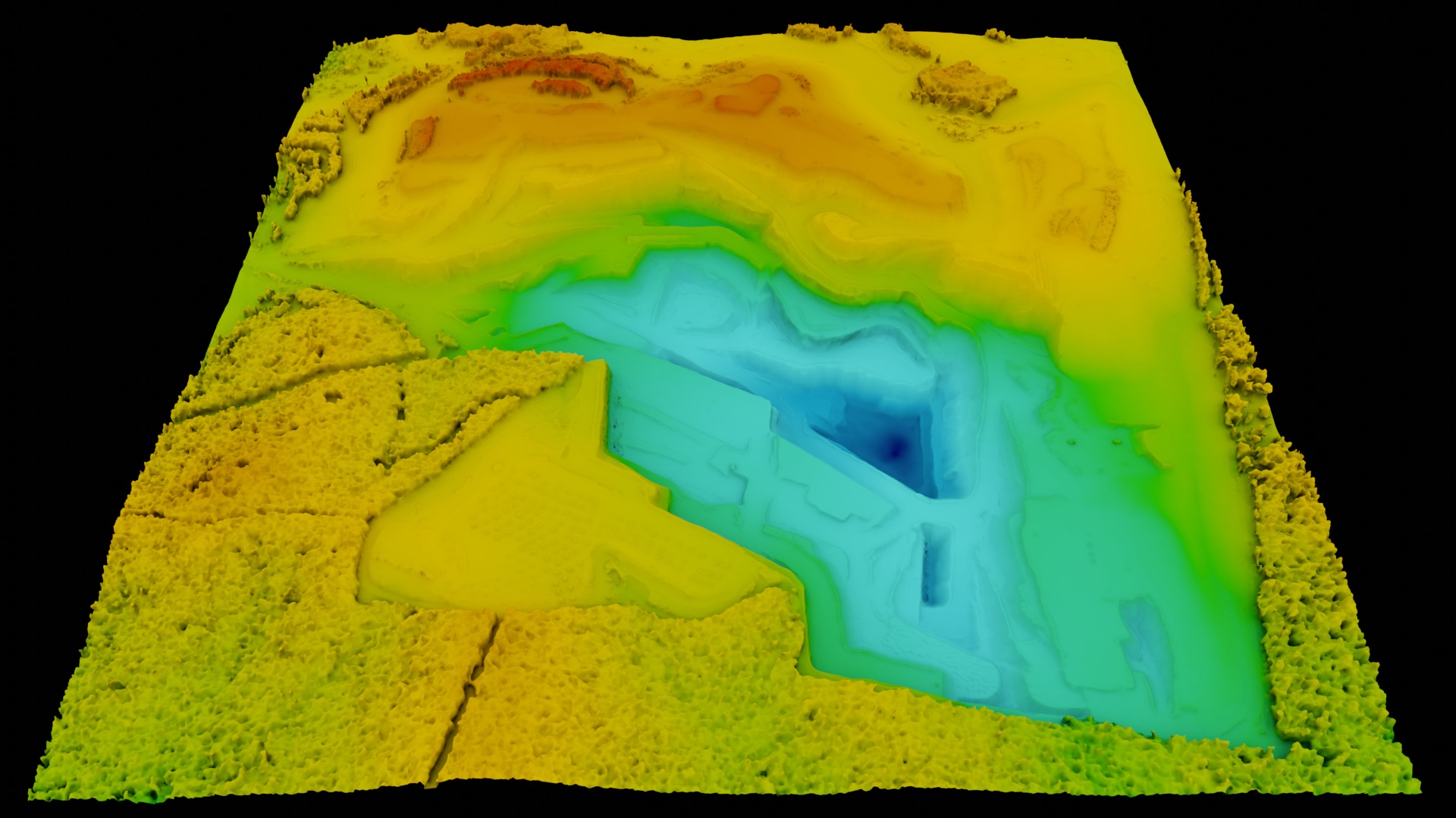
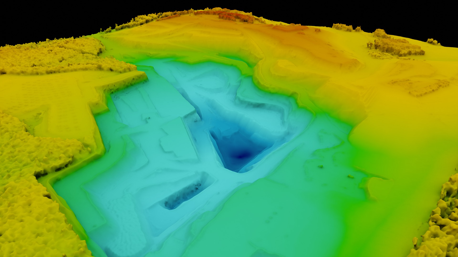
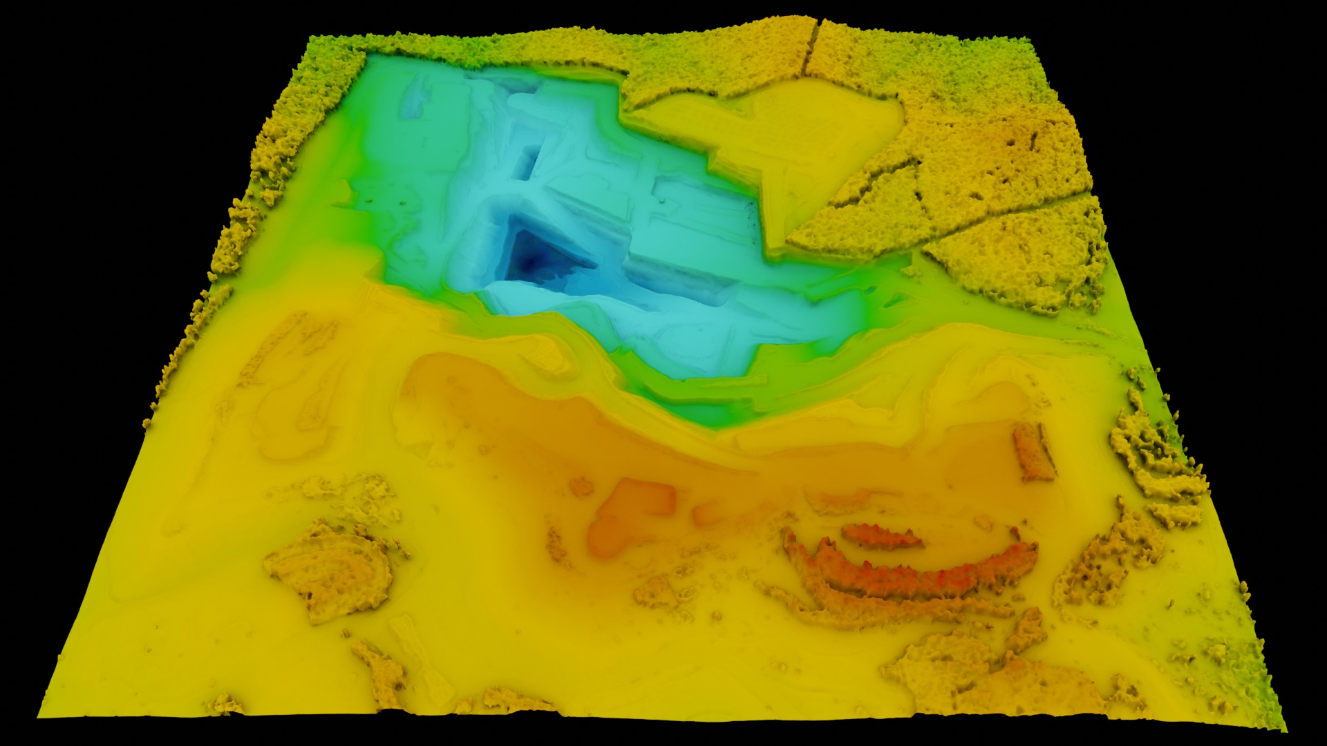
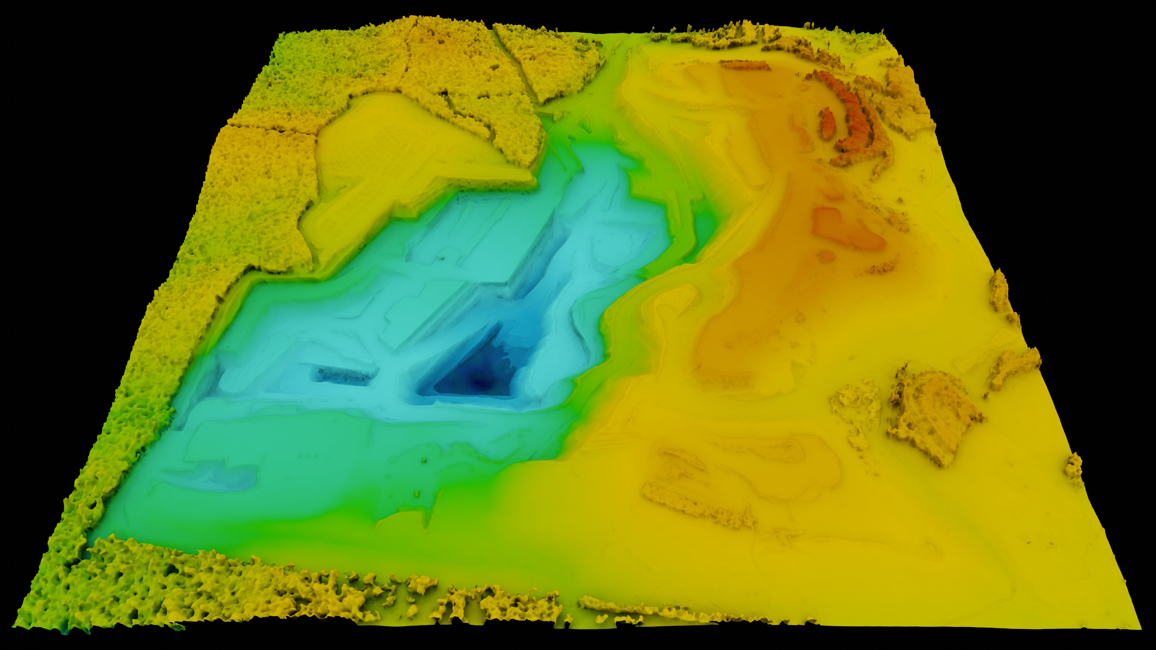
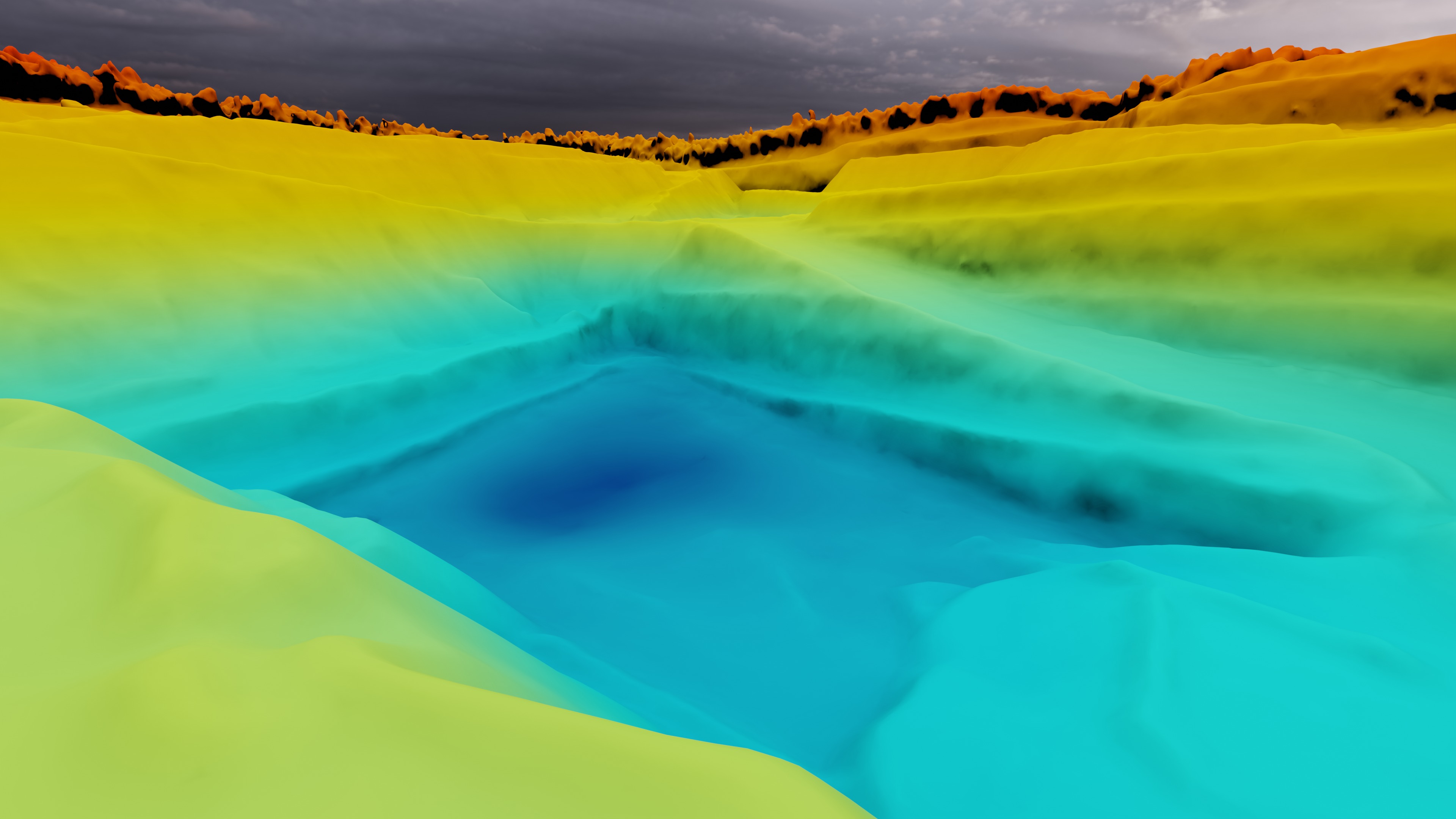
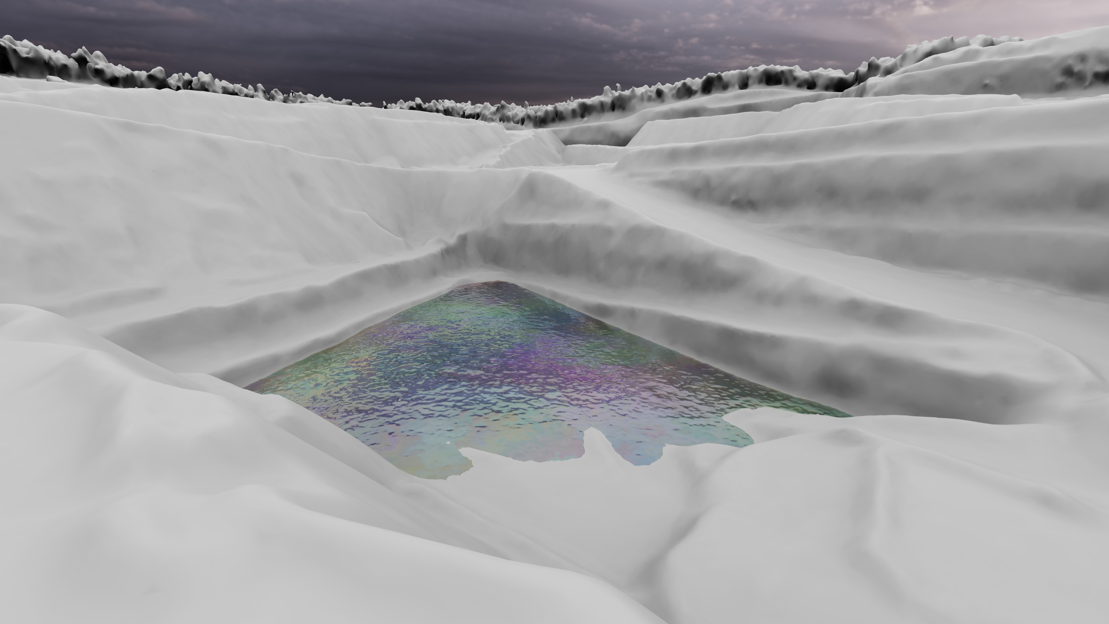
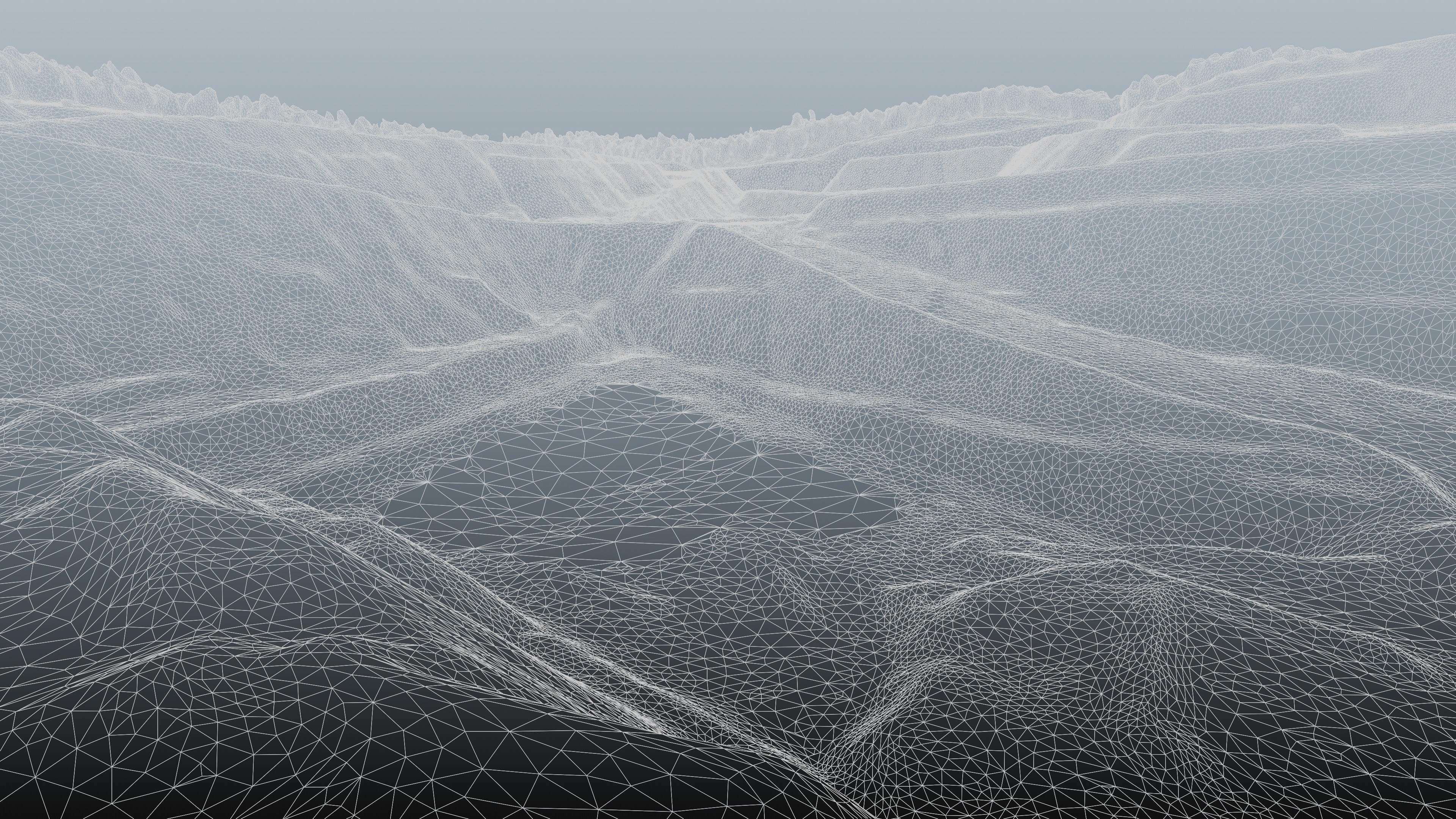
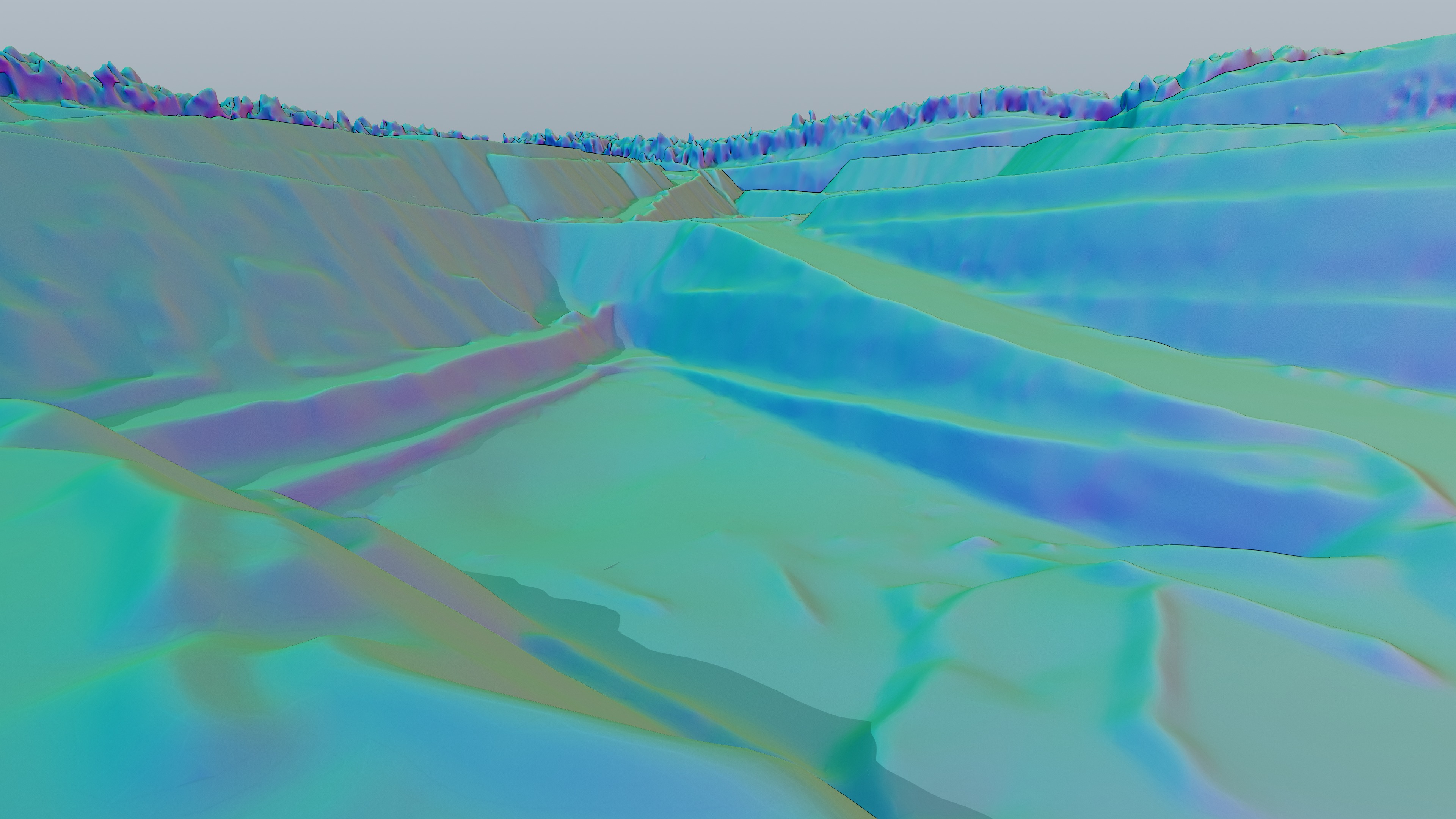
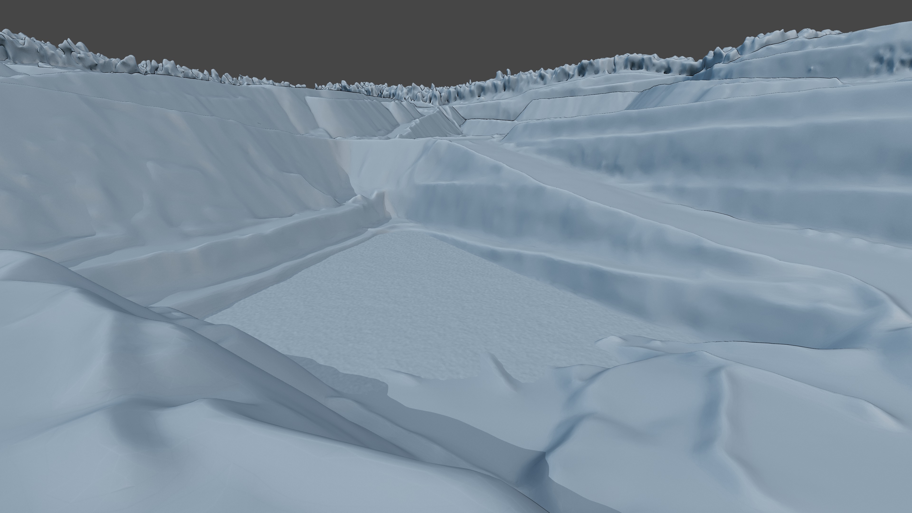
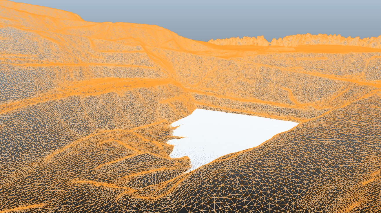
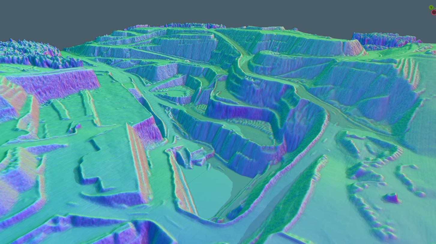
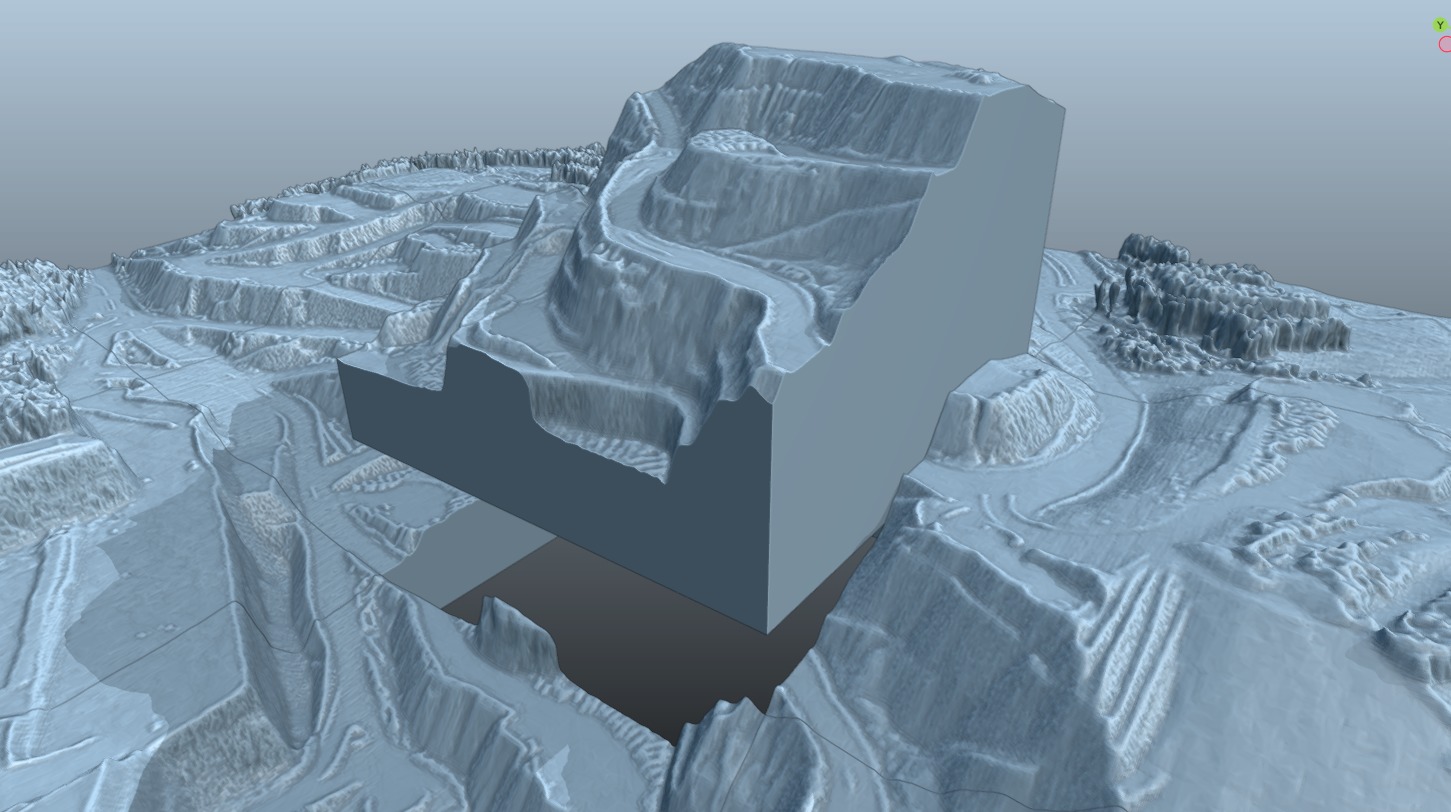
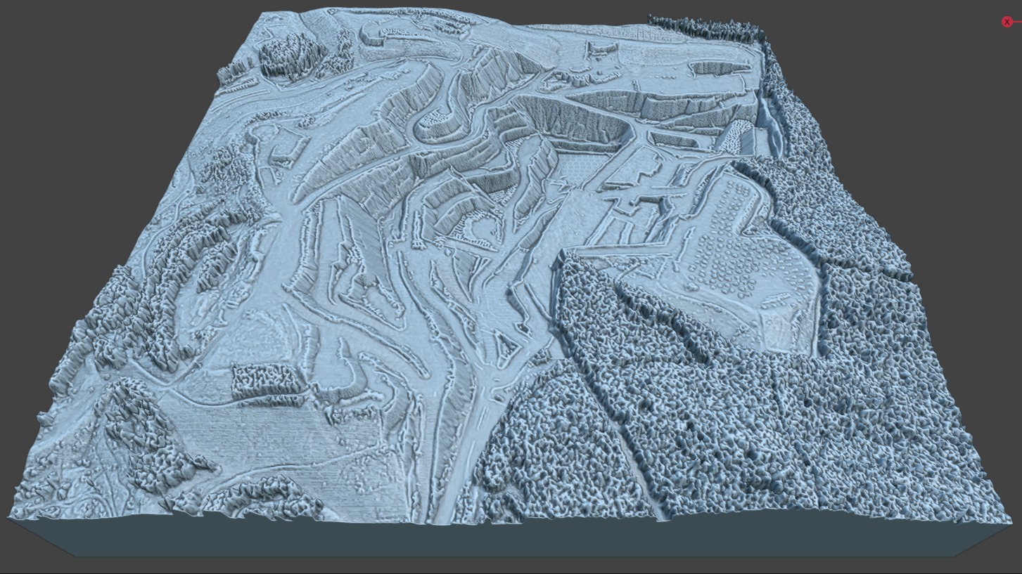
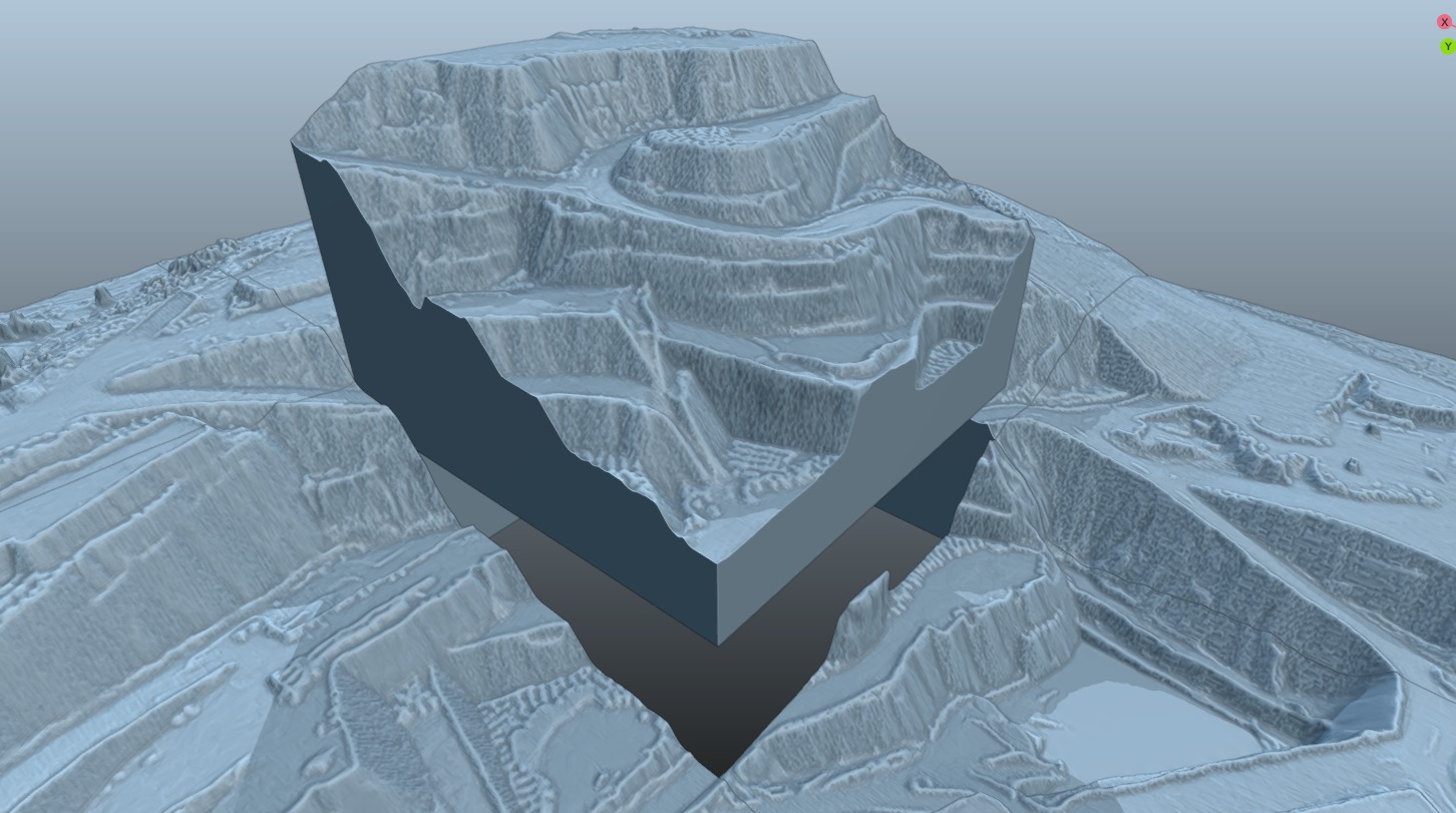
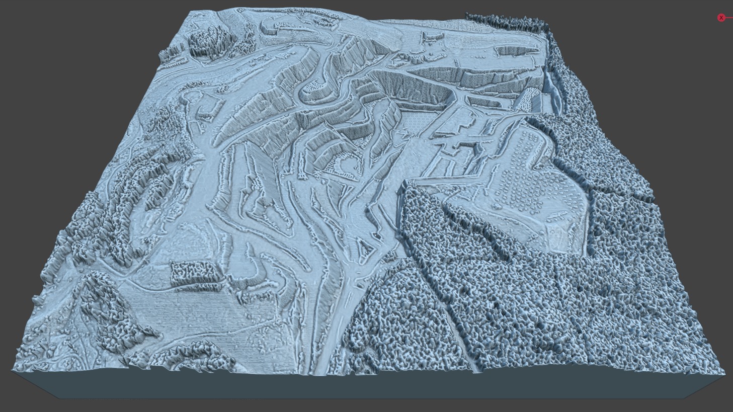
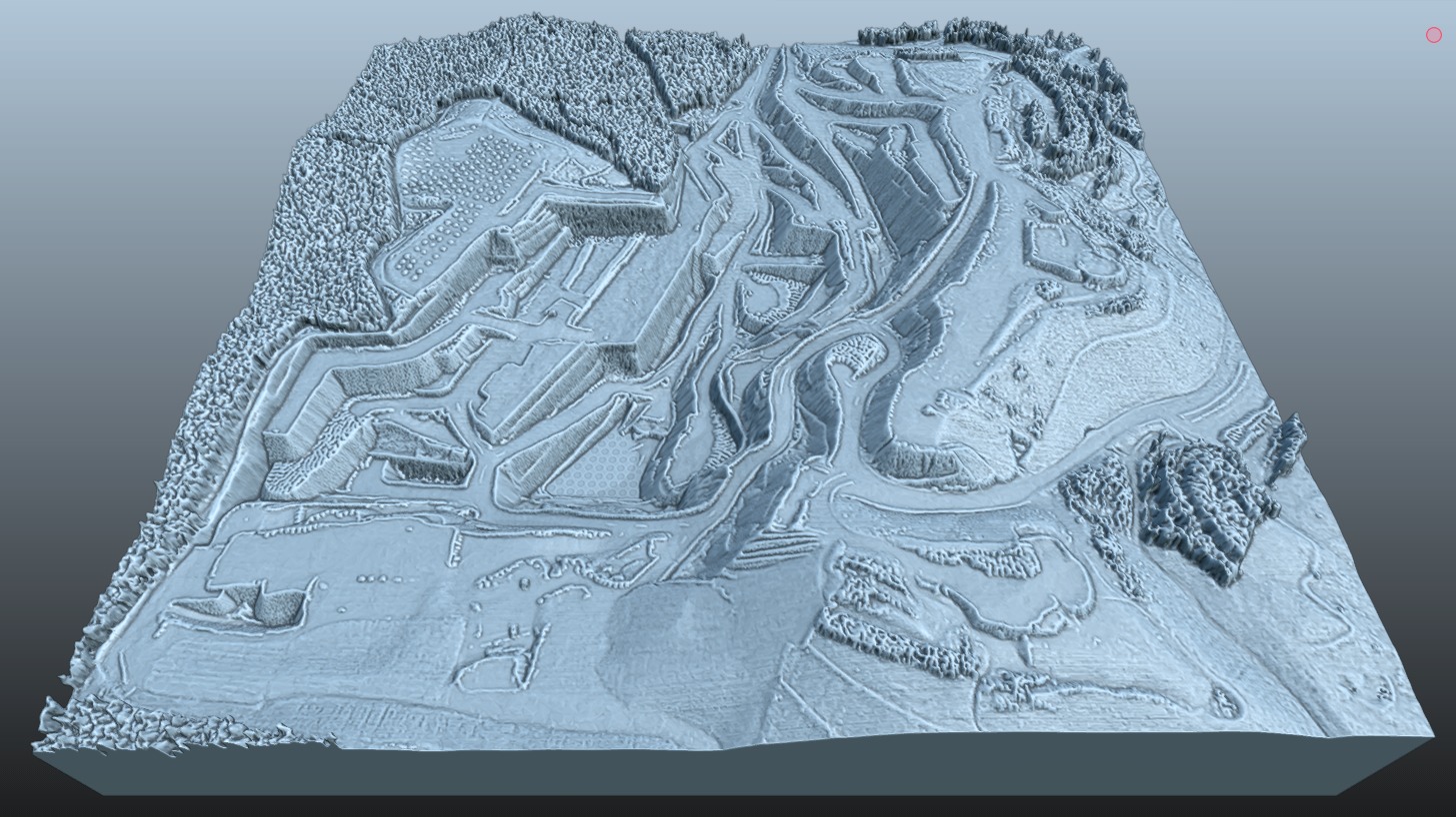
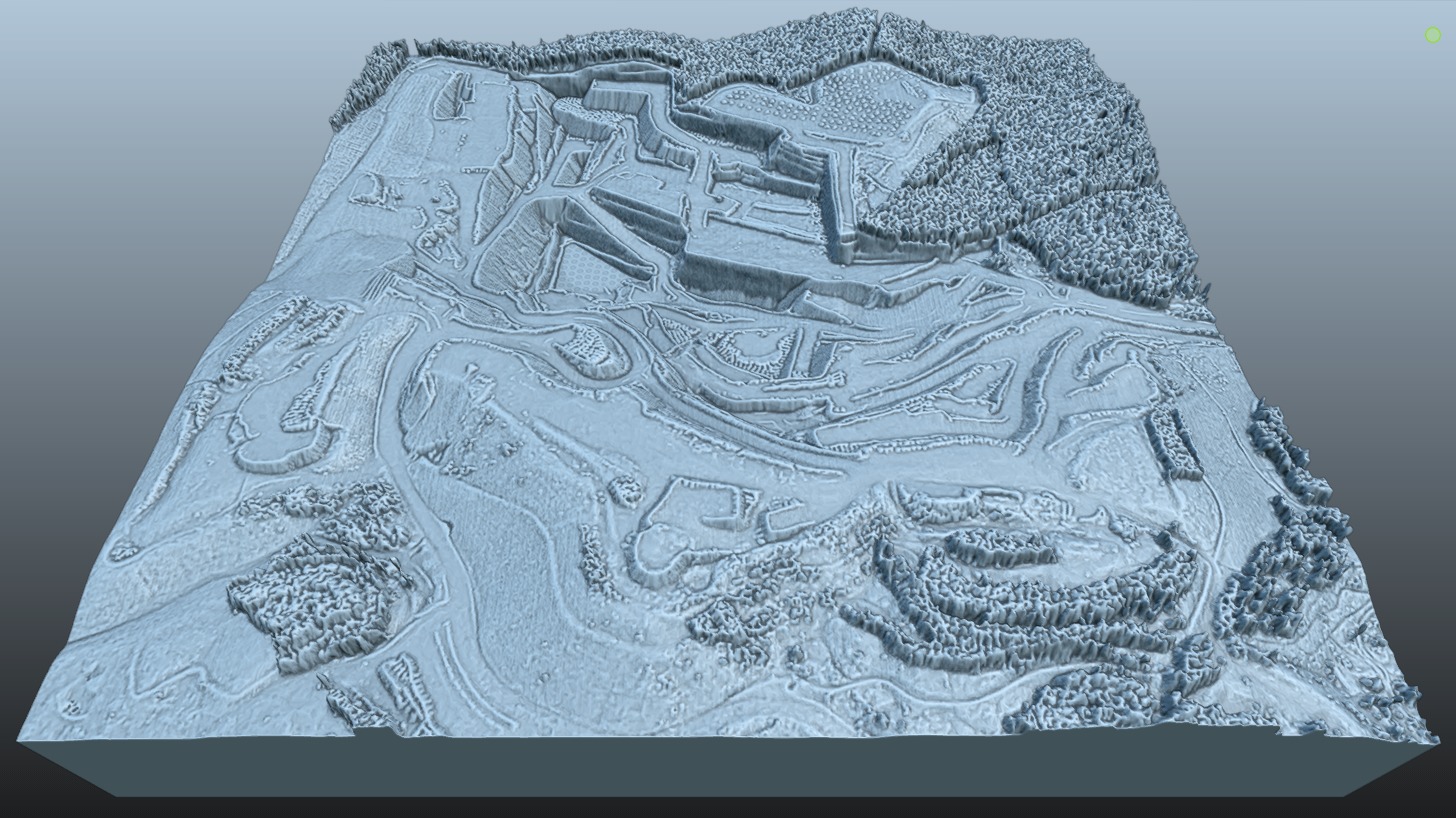
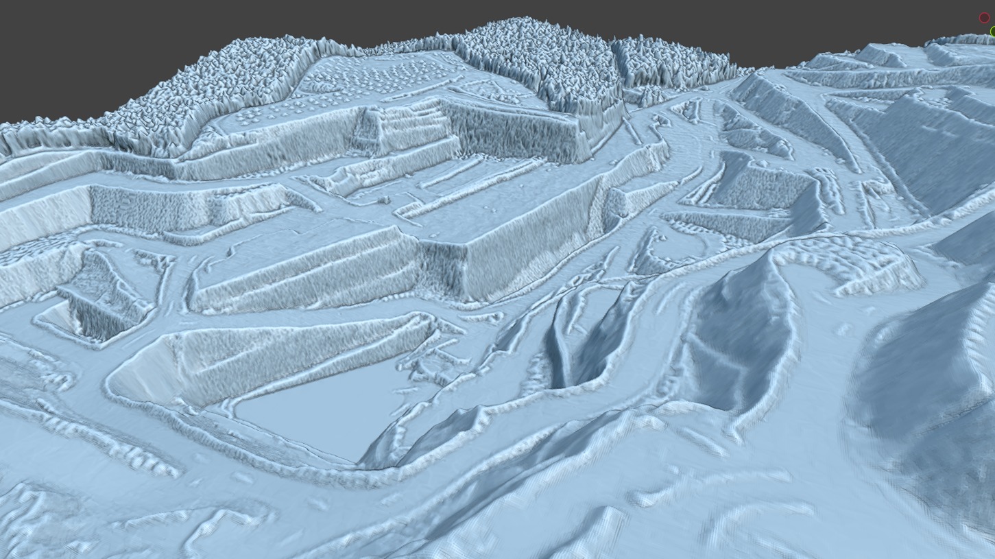
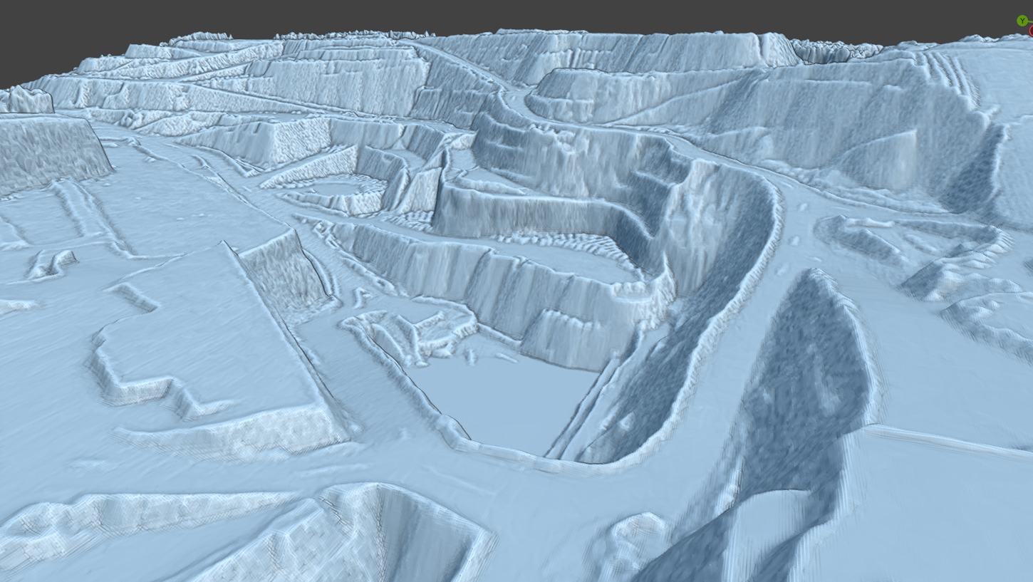
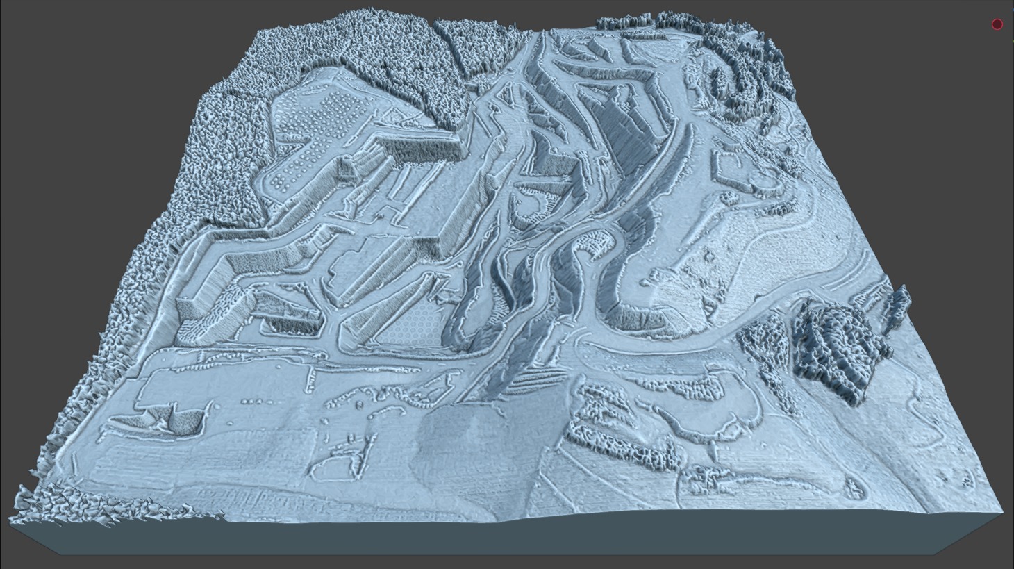
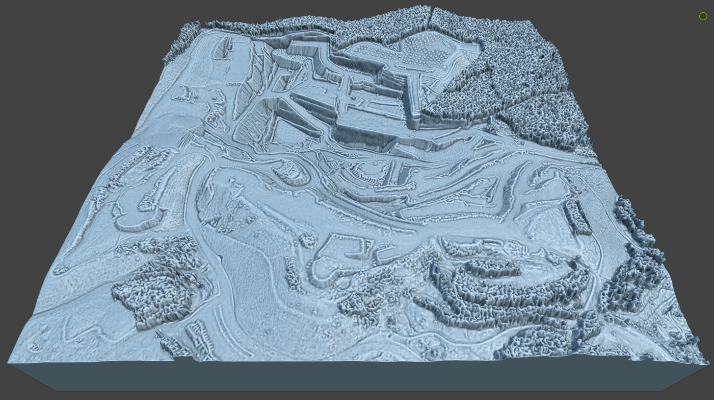
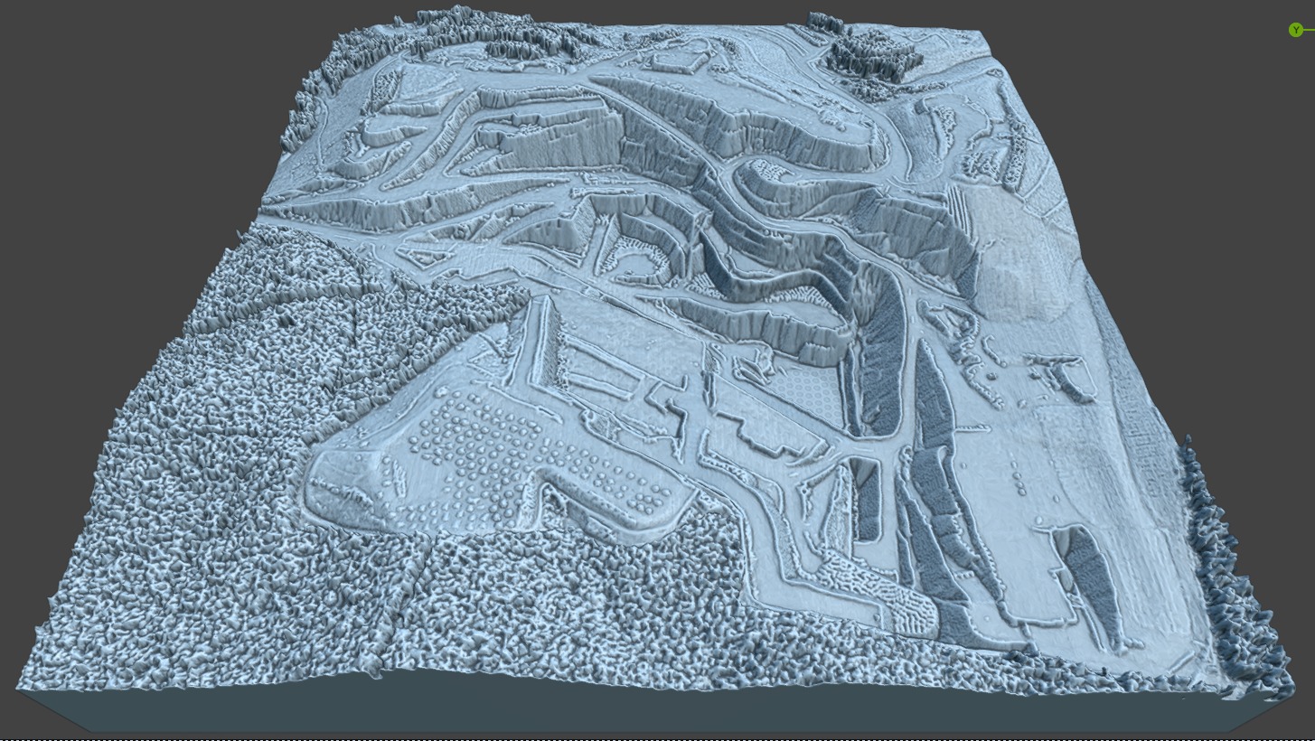
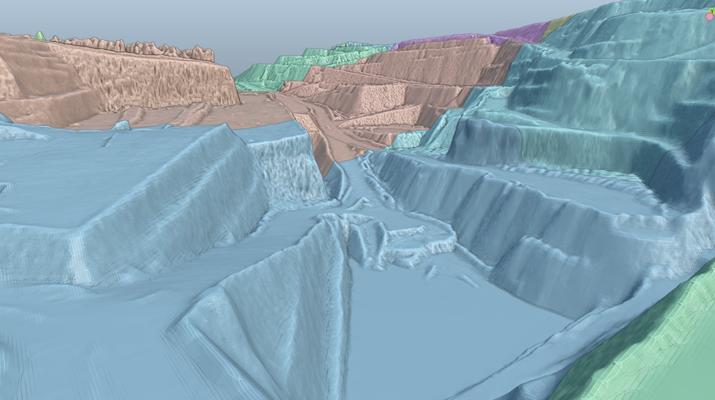
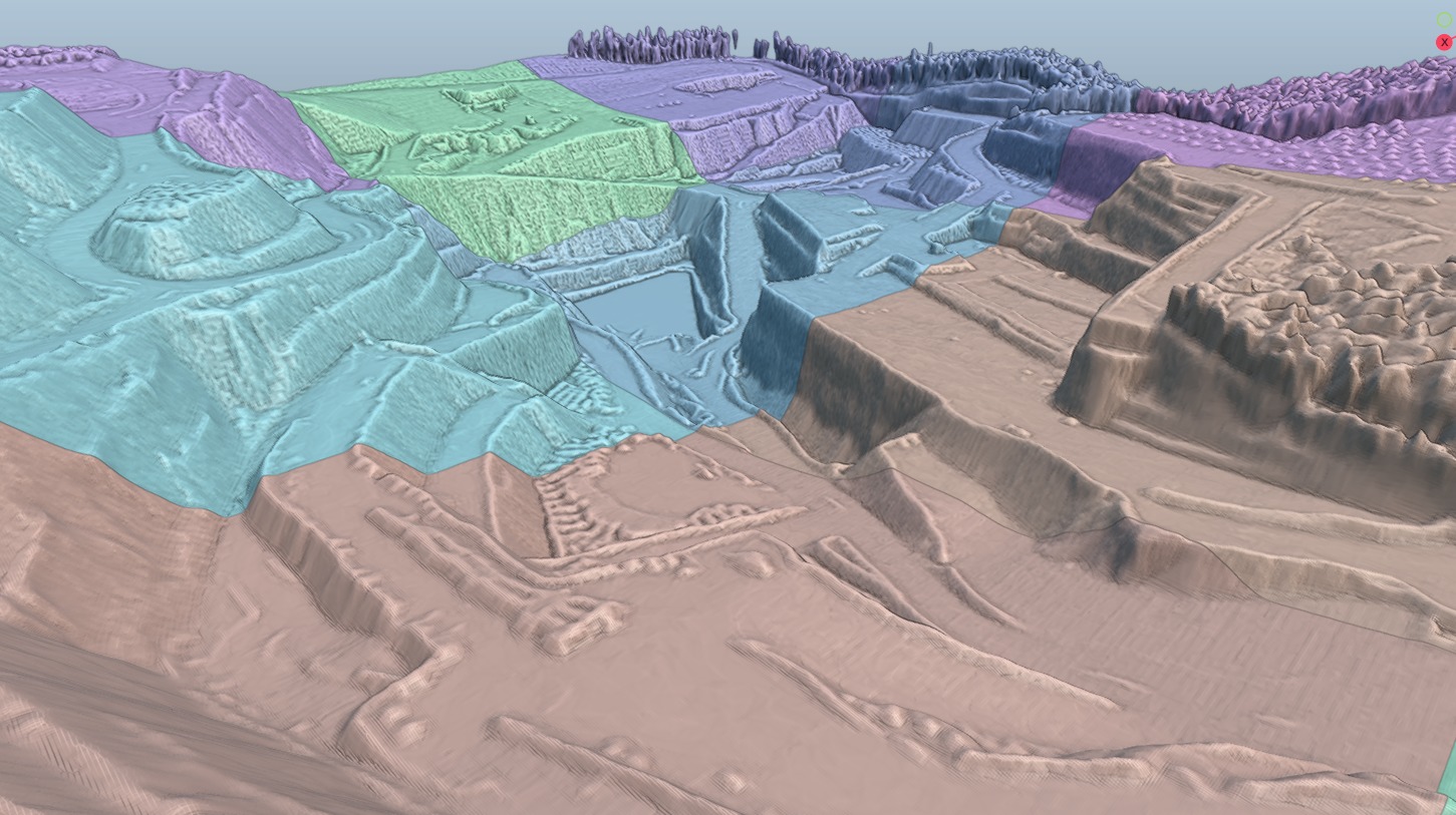
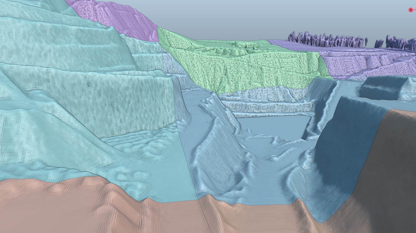
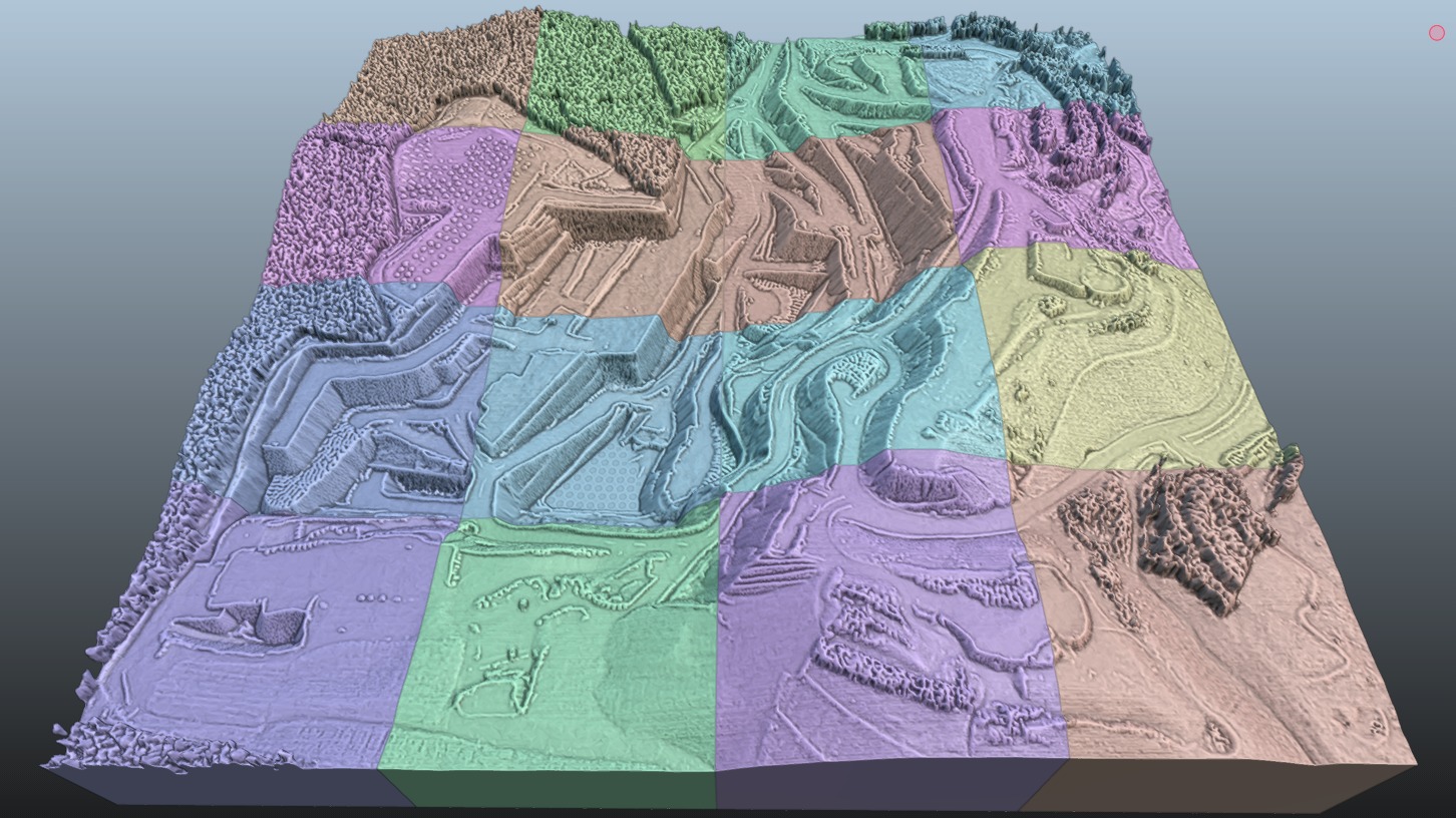
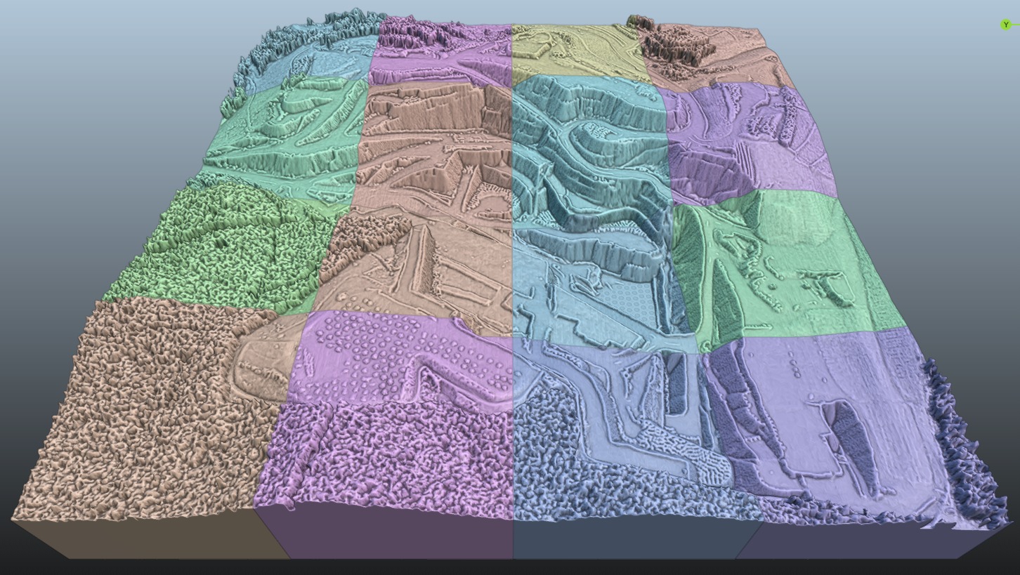
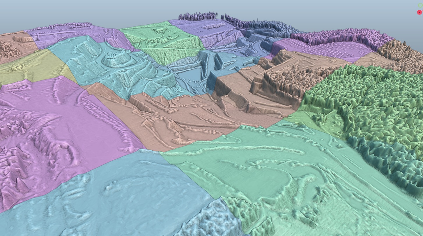
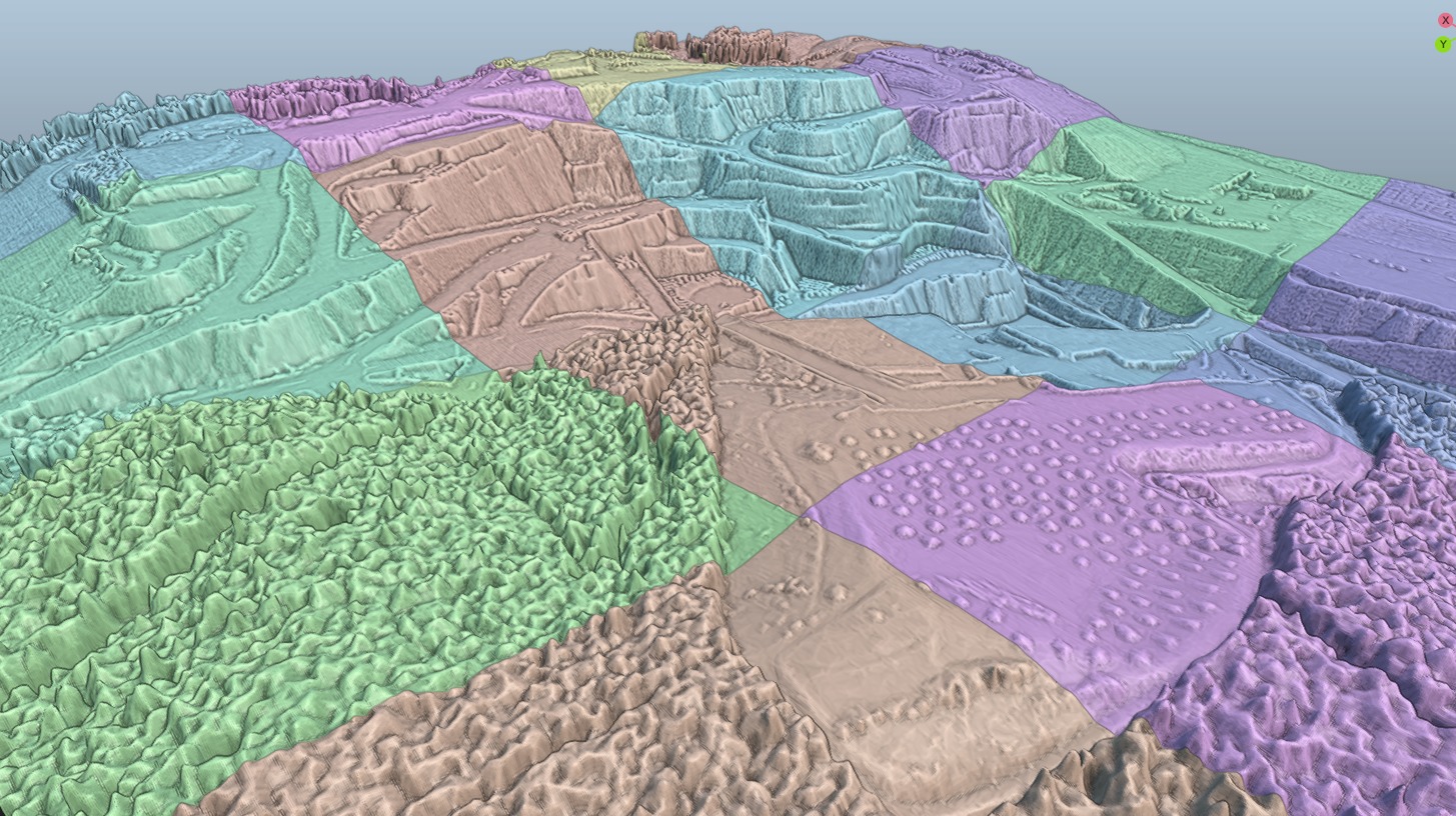
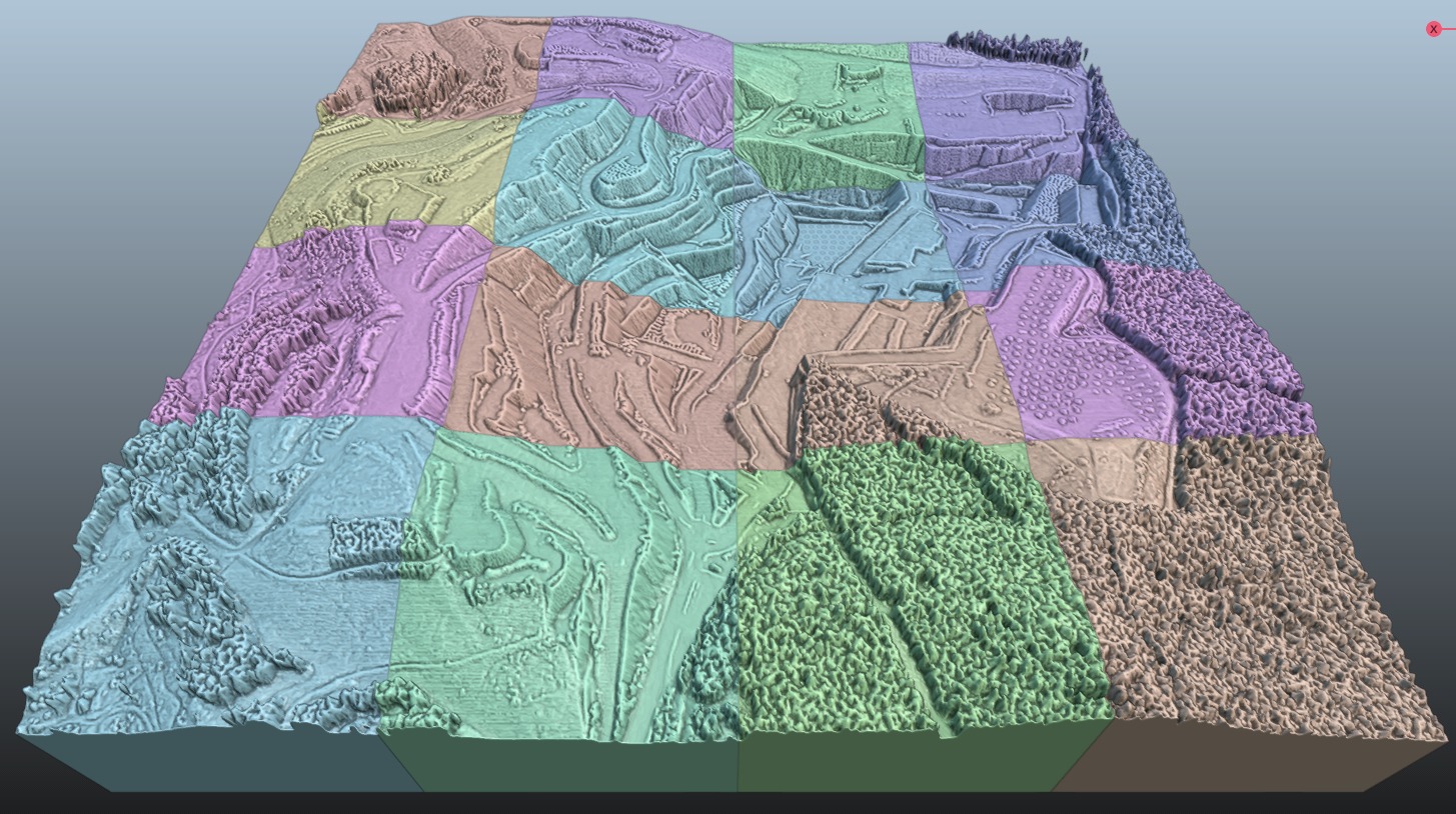
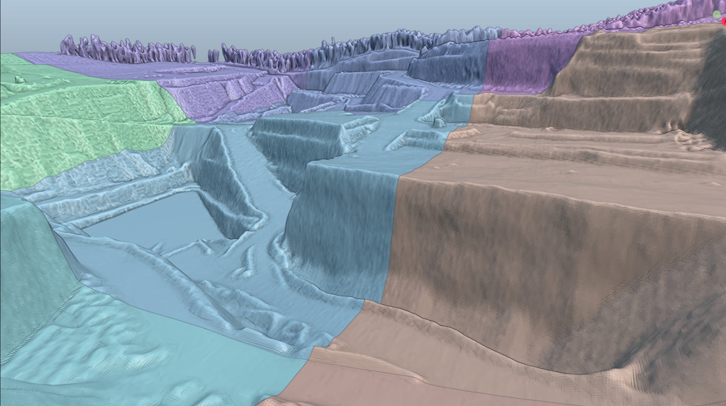
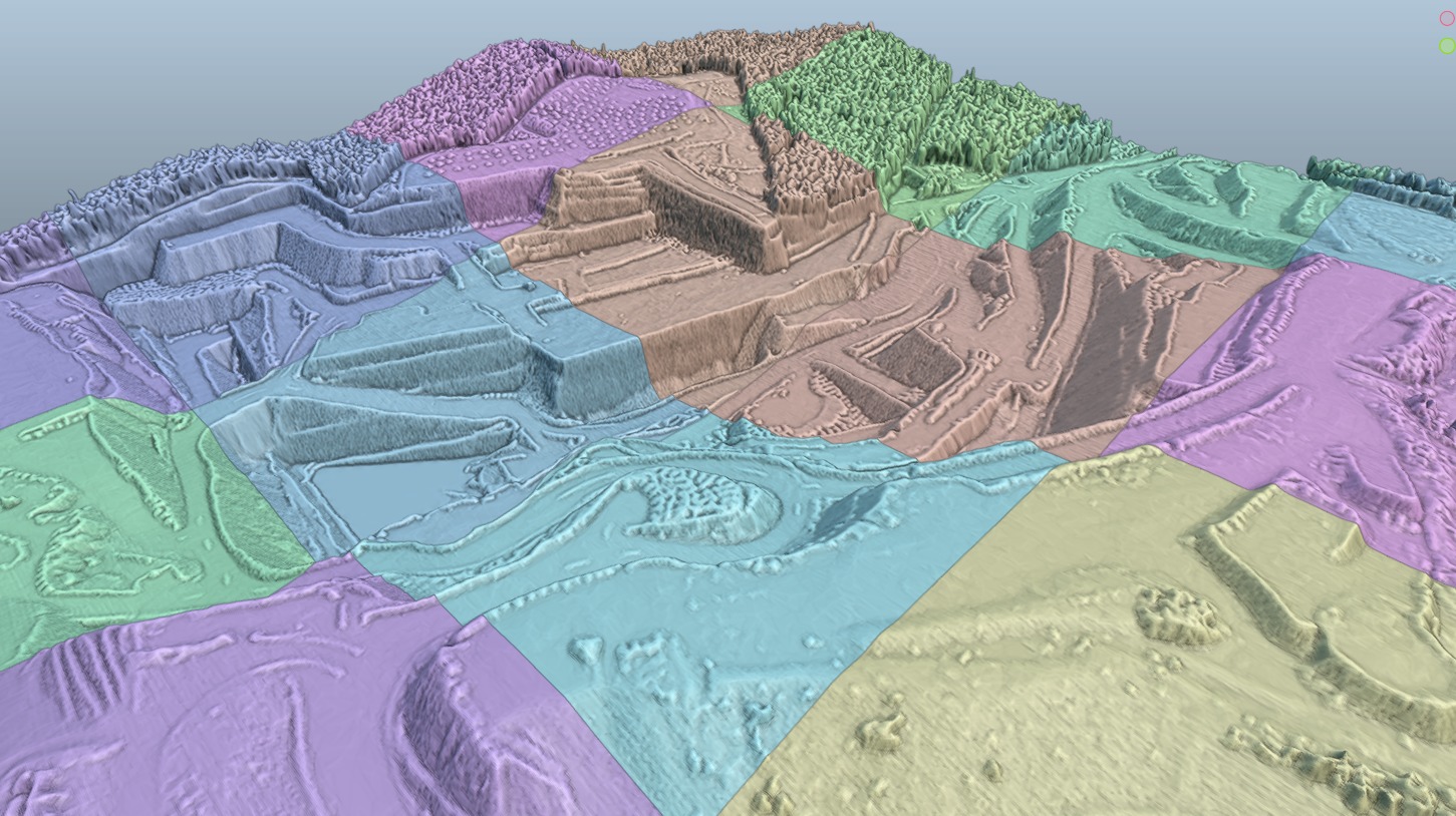
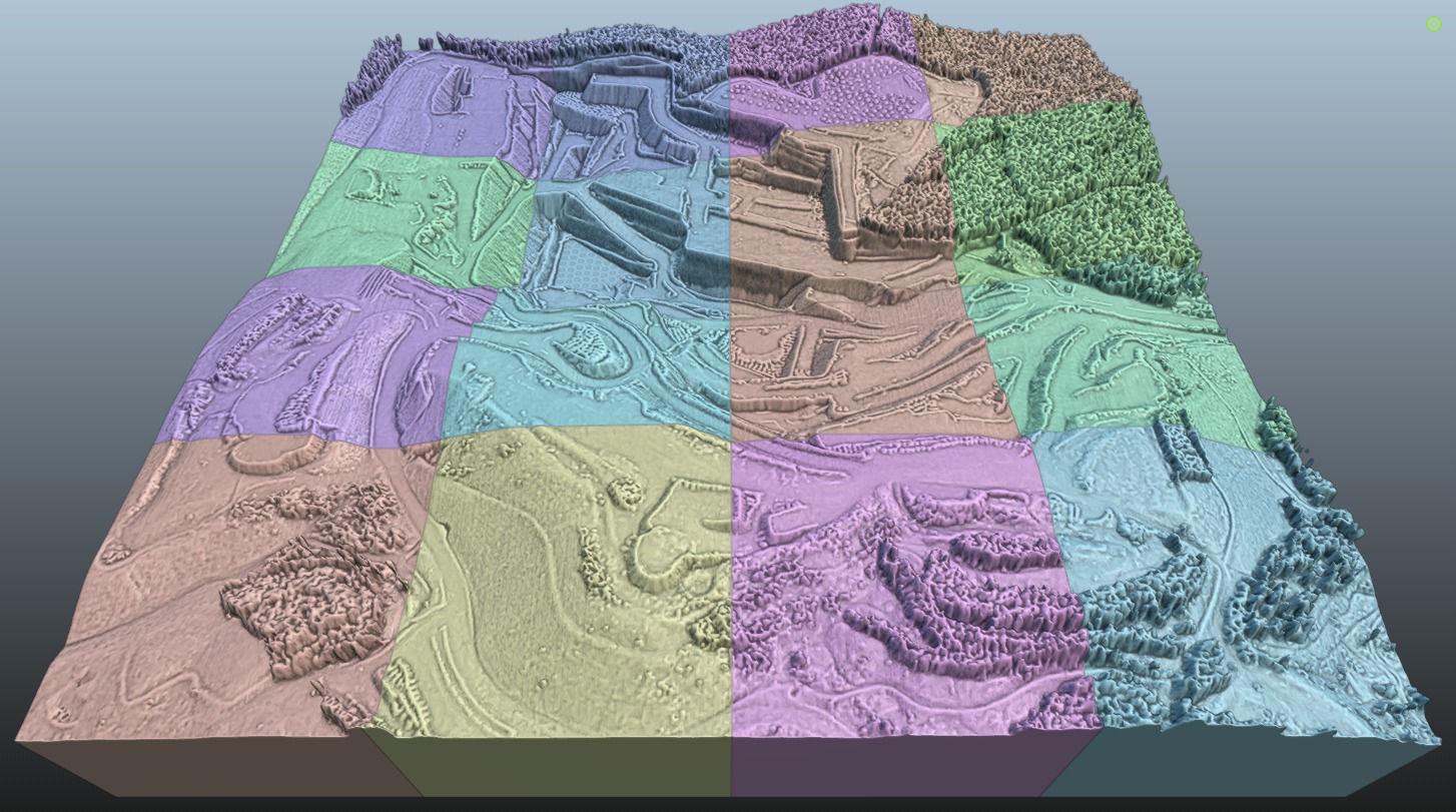
Please read description and check all thumbnails to access package content before buy.Developed from long range imagery and elevation data, the model was built as an irregular triangulated grid mesh with optimized geometry (reduced polycount) and depicts an approximated area of 557ha/1377ac with elevations ranging from -57 below sea level to 125 meters above sea level. Generated at full scale, metric system under controlled precision to ensure correct proportions (UTM projected coordinates) this model can be used in several contexts. Package includes Terrain mesh plus three texture maps (diffuse, normal, occlusion) 32k map resolution (obj, mtl, jpg formats), Terrain mesh with embedded texture (fbx format)Realistic scene with terrain mesh, environment sky (two options), base texture, water plane, several light sources and multiple cameras setup (blend format with external maps setup).Raster elevation model XYZ projected coordinates (.geotiff format)Solid terrain model, trimmed and remeshed as regular quads topology ready to 3D printer or CNC lathe (stl format, metric at full scale, usually show up as millimeters in the device controller). A tiled version is also included for larger format mockup. This includes 16 individual tiles labeled accordingly from R01C01 to R04C04. Model was brought close to origin XY origin to improve rendering performance, elevation was kept as original. Mind that realistic scene is only available in blender file. Contact me if you need some more information about the model or if you need a similar model to a different location.

3D Model formats
Format limitations
- Blender 3.2.1 (.blend)375 MBVersion: 3.2.1Renderer: Cycles
- OBJ (.obj, .mtl) (2 files)463 MB
- JPG (.jpg)232 MB
- Autodesk FBX (.fbx)223 MB
- Stereolithography (.stl) (2 files)349 MB
- Other 40.7 MB
3D Model details
- Ready for 3D Printing
- Animated
- Rigged
- VR / AR / Low-poly
- PBR
- Geometry Polygon mesh
- Polygons 1,856,759
- Vertices 932,149
- Textures
- Materials
- UV Mapping
- Unwrapped UVs Mixed
- Plugins used
- Publish date2024-10-22
- Model ID#5597933
Similar Models

Users who bought this item also bought...
